Behind Curtain of Fire, A Land Disfigured By Man and Drought
Can a Century of Canal Digging, Channel Constructing, Man Made Plumbing Be Undone
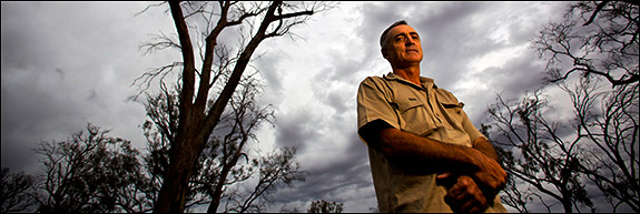 Once a farmer now a conservationist, Greg Ogle stands among Australia’s giant Red Gum trees northwest of Swan Hill that the epic drought has killed (click image to enlarge).
by Keith Schneider
Photographs by J. Carl Ganter
Circle of Blue Reports
Greg Ogle, who is 49 years old, once farmed along the northern banks of the Murray River, not far from Swan Hill. He came of age in the 1970s when regular floods filled the wetlands near his home and the centuries-old and hollowed out river Red Gum trees provided nests for snakes and the small mammals they hunted. It was easy then to see big Goanna Monitor lizards, stout as logs and nearly as long as a man is tall, resting on the thick branches of the towering trees, a species as iconic to Australians as maples and oaks are to Americans.
Today Red Gums are dying all across the Murray-Darling Basin. Frogs and snakes and small mammals are gone, and Goannas are rarely seen. Ninety percent of the basin’s wetlands have disappeared or have been seriously damaged, according to reports by the Commonwealth Scientific and Industrial Research Organization (CSIRO), Australia’s principal science agency. Clearing forests and brush for grazing and agriculture is raising salt content in soil to toxic levels. Farm chemicals seep from the land into the rivers, killing fish. Poisonous algae blooms, like one that covered nearly 700 miles of the Darling River in 1990 and 1991, are an ever-present danger. Bushfires are getting hotter and more frequent.
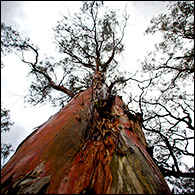
Red gum trees tower in a parched billabong near Swan Hill. According to the Commonwealth Scientific and Industrial Research Organization (CSIRO), drought and climate change are threatening the future of these iconic Australian trees (click image to enlarge).
“I see vast changes just in my lifetime,” said Ogle, who switched careers and is now a conservationist with Trust For Nature, Australia’s oldest and largest land conservancy. “It’s very alarming. We aren’t a long-lived species and to see these vast changes in a lifetime is quite distressing. We can actually see several species that disappeared. We’ve watched wetlands die. The alarming thing about it all is the snowballing effect of those changes. A lot of it is yet to come.”
Indeed, that is precisely the conclusion reached by CSIRO and by more than a dozen other university and private research centers in Australia that have produced predictive models in recent years about environmental conditions in the Murray-Darling Basin.
In 2005 and again in 2007, for example, the CSIRO participated in studies that cautioned that Australia’s warmer and drier weather, the result of global climate change, would significantly increase the incidence and severity of wildfire. Australia, no stranger to bushfires, experiences nearly 1,000 a year. And southeast Australia, where the landscape is dominated by fast-burning eucalyptus species, and where hundreds of thousands of people live in semi-rural suburban communities, is particularly vulnerable.
The 2007 CSIRO study said there could be up to 65 percent more “extreme” fire-danger days compared with 1990, and that by 2050, under the most severe warming scenarios, there could be a 300 percent increase in fire danger.
Another CSIRO study last year found that as carbon dioxide concentrations in the atmosphere climbed 3.5 percent a year, southeastern Australia warmed 1.6 degrees Fahrenheit since 1950. On average, 15 percent less rain falls now. If trends continue as they are, rainfall will continue to diminish, said the study, and the region will be 4.4 degrees warmer by 2050. Summed up, climate change is turning southeast Australia into one of the industrialized world’s most perilous zones for plants, animals, and people.
On February 7, just as scientists predicted, a wildfire of unusual intensity and speed erupted north of Melbourne, burning across 1,500 square miles of Victoria, destroying 1,800 farms and homes, and killing 210 people. In the aftermath, Victoria Premier John Brumby, and John Connor, the chief executive of the Climate Institute, a respected research group, declared the disaster “fires of climate change,” and called for much more concerted action to reduce global warming gases. They were joined in seeking tougher government limits on global warming pollution by 13,000 professional firefighters.
As awful as it was, the curtain of flame that roared across Victoria was one more facet of the growing environmental emergency that is unfolding across southeast Australia and the Murray-Darling basin. Though it is difficult to measure, perhaps nowhere else in the industrialized world has climate change produced such inordinate damage to natural systems that already were under extreme stress from a manmade shortage of moisture.
The waters of the Murray River and its tributaries are so intensively dammed and channeled for irrigation that four out of 10 days the river doesn’t have enough flow to reach its mouth in the Southern Ocean near Adelaide. When it does rain erosion in the basin fills wetlands and billabongs with sediments, eliminating habitat that is vital for fish and birds to breed. A recent government study found that the condition of all but one river in the 400,000 square mile basin was poor.
One particularly grim aspect of the region’s big dry is that the bottoms of the lakes and wetlands at the end of the Murray, among them Lake Alexandrina and Lake Albert, are exposed now to air. Sulfides exist in the sediment and when oxygen from the atmosphere mixes with the mud, sulfuric acid forms.
“Acid mud,” as its known in Australia, is contaminating water in wetlands further and further upstream along the Murray and Darling rivers according to surveys by the commonwealth and the states. In some places the Ph levels are comparable to battery acid.
“The ecology of our rivers is under serious, serious threat. Particularly the ones at the end of the river systems, and at the bottom of the Murray,” said John Williams, the former chief of CSIRO’s land and water division, and a noted global authority on ecology and land use. “Recent studies have shown that as much as 70 percent of the wetlands that have been surveyed, the billabongs that have been surveyed, are suffering from acid-sulfide condition. The water in the sediments is turning acid and releasing heavy metals into the water system. So they’re very unhealthy. The consequence is that the ecology is being damaged in many places.”
In fact, say scientists and conservationists, there are precious few places in the Murray-Darling Basin that aren’t being damaged. In the upper reaches of the Darling River system the globally renowned Macquarie marshes, a 110,000-acre aquatic wilderness, a breeding ground for birds and fish, are steadily drying up. At the mouth of the Murray River, more than 1,000 miles downstream, the even bigger Coorong wetland also is shrinking.
And in countless small wetlands and billabongs, the oxbows that once regularly filled with floodwaters and served as primary habitat for all manner of fish and mammals, reptiles and birds have disappeared.
The Murray-Darling Basin is a big, enveloping, and highly variable ecosystem. There is nearly as much diversity in how Australia’s scientific community views the permanence of the damage. Julian Cribb, a journalist and respected professor of science communications at the University of Technology in Sydney, is convinced that what he calls “the whole of Australian biology” is like a desert storage shed, designed by time to endure long periods of droughts followed by bursts of flooding. When the rain returns, and it will Cribbs asserts, the land will jump to life.
“If you have ever been in the Australian desert when it has rained you are astonished at the way biology renews itself,” said Cribb. “An empty sandplain stretching to the horizon becomes a carpet of flowers. Shrubs burst into seed. Frogs and shrimps appear miraculously within 24 hours in creek beds that had not held water for a decade or more. Winged termites fountain out of the dry land. Birds appear in millions.”
“This ebb and flow has happened many times in the past,” Cribb added. “This is important for perspective, as what humans are doing has been done by nature many times in the past. And will be done again in future.”
A few miles from where Greg Ogle lives with his wife and two boys in a ranch house surrounded by miles of uninhabited Australian bush, he stands underneath a dying Red Gum tree and explains the changes he sees all around. Ogle, like many other prominent Australian environmentalists, is not nearly as sanguine about the region’s ability to recover as Cribb.
Even before southeast Australia’s epic drought began in 1997, Ogle said, the Murray-Darling Basin’s serious ecological decline became apparent as growing numbers of Red Gums began to perish. The Red Gum die off has steadily become an epidemic, not unlike how disease wiped out the American elm. But it’s not an invisible bacterial infection wiping out the Red Gum, says Ogle and other experts. It’s how the region’s vast system of dams, reservoirs and channels obliterated the natural free flowing rivers that regularly topped their banks and flooded the wetlands, and billabongs, and lakes.
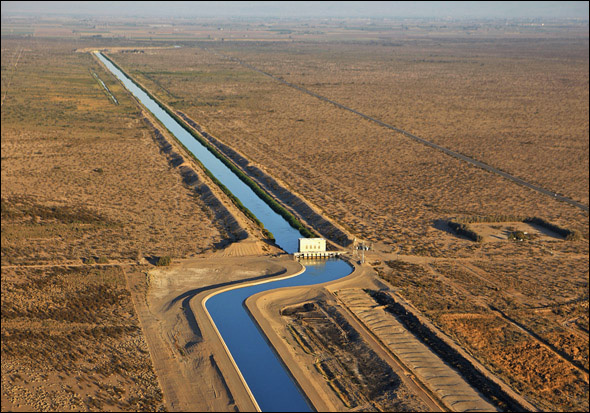
The Murray-Darling Basin’s vast plumbing system – dams, channels, reservoirs, and canals – was constructed over a century from the 1880s to the mid-1980s. The infrastrucutre succeeded in securing and distributing just about every available drop of water in the region for agriculture. The Murray-Darling Basin is Australia’s primary source of food, and one of the planet’s most important food bowls.
But before the irrigation network was installed, the Murray-Darling basin flourished on free flowing rivers and streams that regularly flooded. The Murray and the Darling, the Murrumbidgee and the Edward and the Goulburn, and every other stream in the basin certainly looked and behaved like rivers. But they were more than that. They were the principal suppliers of energy to much larger aquatic systems. In the dry season, the rivers cut lazy bends, back and forth, across the basin’s astonishingly flat ground. In the wet season they delivered and drained flood waters from the billabongs and small wetlands and lakes.
“We haven’t had anywhere near the average rainfall for a long time,” said Ogle. “And we are now regulating the river to the point of extreme. All the water is caught and held back and let go down the river to the water users who own the water rights. Most of the water is owned. People have titles to the water. So over-the-bank flows don’t happen regularly at all, very rarely. These wetlands are dying now. Our ancient Red Gums are dying. These trees are several hundred years old and are just dying from lack of flood and lack of water. “
Ogle pauses a moment. His eyes follow his eight-year-old son, Murray, who is out on flat ground beyond the Red Gums chasing rabbits with their nine-month-old whippet, Zipper. Before the drought, the area surrounding his home had already lost 14 species of small mammals, birds, and reptiles to extinction, Ogle says. More species of small fish and birds are so rare, they also may be gone. “The drought comes into this as one of the final nails in the coffin,” he says. “This forest right here that used to be full of frogs, and snakes that eat frogs, like tiger snakes and black snakes. They’re all gone. Some species like the southern bell frog is in danger of extinction across the Murray Darling Basin.”
In the state capitals and in Canberra, the capital of the commonwealth, scientists and policymakers have been huddling for a generation to develop solutions that may not be achievable – allocating ever scarcer supplies of water in a way that keeps farmers on the land and also serves the region’s natural systems. In 1992, the states and the commonwealth changed a 77-year-old system of law and regulation to form the Murray-Darling Basin Commission, which was given new authority to cap how much water was available for farming, and increase allocations of water for environmental restoration.
In the first decade of the 21st century, the states agreed to allow the commonwealth to assert more oversight of the region’s water. The commonwealth and the states also committed to spend $12.5 billion to modernize the irrigation network to significantly reduce leaks and waste, change farm practices to conserve water, and buy water rights from farmers in order to restore some of the river’s natural flooding. It’s too early to tell whether the investment is working. Most reservoirs across the basin are half full or lower. The drought shows no sign of ending. Conditions are getting worse.
“The government and policymakers are now forced into a corner where they are having to choose which wetland can get a drink and which wetlands are shut off from water and will not get a drink again,” said Ogle. “The waters are now being divided up.”
As he describes the dynamics of a natural system grievously injured by man, the landscape around Ogle is steadily revealing the consequences. A wetland that two decades ago was inundated by its last great flood is now dry. A nearby lake that 20 years ago was deep enough to swim in, and big enough for water-skiing, is dry. Salt bushes and other arid species are replacing the Red Gums. Mother nature is turning what’s left of southeast Australia’s prolific wet ground to dry land. You can almost hear the old Red Gums wail.
Keith Schneider, a former New York Times national correspondent, is senior editor and producer at Circle of Blue. J. Carl Ganter, an award-winning photojournalist, writer and broadcast reporter, is the co-founder and director of Circle of Blue. Contact Keith Schneider or contact Ganter at carl.ganter@circleofblue.org. For a complete list of credits, acknowledgements and other resources related to Circle of Blue’s coverage of “The Biggest Dry” please click here.
Circle of Blue’s senior editor and chief correspondent based in Traverse City, Michigan. He has reported on the contest for energy, food, and water in the era of climate change from six continents. Contact
Keith Schneider




Leave a Reply
Want to join the discussion?Feel free to contribute!