Iraq’s First National Park: A Story of Destruction and Restoration in the Mesopotamian Marshlands
The inauguration of Iraq’s first national park earlier this summer represents a step toward national rebuilding for the war-torn country. But restoration of Iraq’s marshes also offers a grander vision for regional water cooperation throughout the Middle East and elsewhere.
By Joanne Yao
Circle of Blue
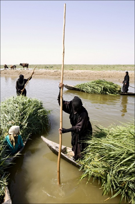
Framed by the Tigris and Euphrates Rivers, many believe Iraq’s tranquil marshlands to be the biblical Garden of Eden. Historians know that these marshes — once the third-largest wetland in the world — cradled some of the earliest civilizations and the first written language. Filled with azure lagoons, swaying reeds, snorting water buffalo, and rare waterfowl, this magical corner of the globe has also witnessed centuries of human conflict and religious strife, however, and is still reeling from Saddam Hussein’s Ba’athist regime.
–Dr. Azzam Alwash
Founder of Nature Iraq
After Hussein’s aggressive campaign to drain the Mesopotamian Marshes in the early 1990s, these millennia-old wetlands were on the verge of disappearing, having been reduced to one-tenth of their original size. But thanks to more than a decade of restoration efforts, the marshlands are slowly recovering. The Basra reed warbler and the Iraq babbler, two bird species that live almost exclusively in Iraq’s marshes, have returned. Moreover, roughly 90,000 of the Marsh Arabs who had scattered during Saddam’s oppressive regime have also returned to live in their native marshland.
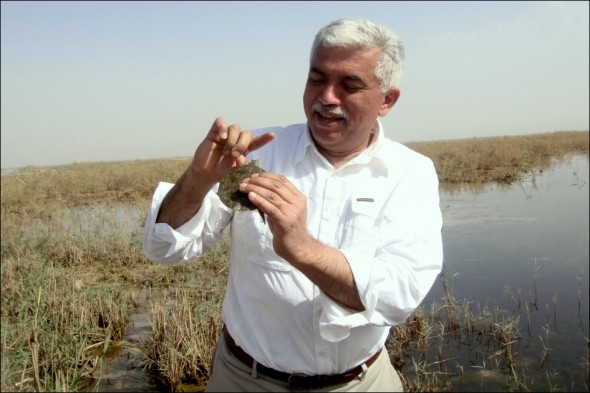
More good news came in late July, when Iraq’s Council of Ministers named the National Park of the Marshes as the country’s first and only national park. In a battle-weary country that still suffers more than 200 conflict-related casualties each week, Iraq’s first national park represents a tentative but concrete step toward national rebuilding and the safeguarding of resources for the future, according to Dr. Azzam Alwash, an Iraqi-American engineer who won the 2013 Goldman Prize in April for his decade of service to the marshlands.
“Strangely enough, this is one of the few cases where war has resulted in environmental healing,” Alwash told Circle of Blue. “The re-creation of the marshes is literally like the rising of a phoenix from the ashes of destruction. In a sense, it is a symbol of the restoration of Iraq as a whole.”
The 1,000-square-kilometer (385-square-mile) national park in Iraq’s Central Marshes will tangibly protect and promote the marshes and oblige policymakers to consider the needs of Iraq’s marshes, as well as their human and animal inhabitants. But the park also raises pressing questions on an international scale about regional water cooperation in the Fertile Crescent, an agriculturally productive swath of land that cuts across the arid and semi-arid Middle East.
The Tigris-Euphrates River System is one of a few pivotal global choke points — including the Nile River Basin in Northeastern Africa and the Indus River Basin in the Himalayan foothills — where shared and increasingly scarce water is the flashpoint for competing political, economic, and environmental interests. Further complicating the equation, rapidly expanding populations intensify economic demand along the rivers, and changing climatic conditions alter the flow of streams feeding into these shared rivers. However, regional cooperation has the potential to help countries share the benefits and costs of managing joint-river resources and save unique places, like Iraq’s marshes, for future generations.
Destruction and Restoration
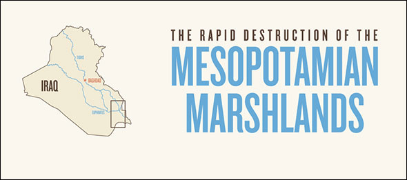
A marsh is a type of wetland that is waterlogged, grass-covered, low-lying, and inundated by seasonal floods. Flanked by the Tigris and Euphrates Rivers, Iraq’s marshes are situated in a region known as Mesopotamia, literally ‘land between two rivers.’ The rivers originate in the snowy mountaintops of eastern Turkey, flow southeast through the dry plains of Syria and Iraq, and are joined by tributaries from Iran. The Tigris, the easternmost of the pair, carves a blue ribbon through the urban sprawl of Iraq’s capital, Baghdad. South of Baghdad, the marshes — covering up to 20,000 square kilometers (7,700 square miles) in the 1960s — behave as a natural filter that scrubs and cleans the rivers’ waters near the end of their journey. Emerging from the marshes, the rivers meet at the city of Basrah and empty 100 kilometers (60 miles) later into the Persian Gulf.
Hussein destroyed the marshlands during the 1990s as an act of repression against the Marsh Arabs, the Ma’dan, who rebelled against his regime. Hussein’s government constructed canals that prevented the waters of the Tigris and Euphrates from overflowing into the marshes; instead, the waters went around the marshlands and emptied directly into the Persian Gulf. He called the diversion canals Saddam River, Glory Canal, and Loyalty to the Leader Channel, among other self-congratulatory names. Within a few years, the marshes dramatically shrank to less than 2,000 square kilometers (7700 square miles), one-tenth of their size during the 1960s.
The son of a government hydraulic engineer, Alwash remembers visiting the marshes with his father as a child. When Saddam Hussein rose to power in the 1970s, Alwash left Iraq for the United States, graduating in 1984 with a masters degree in civil engineering and in 1988 with a doctorate in geotechnical enginnering from the University of Southern California’s Viterbi School for Engineering. He started a successful business, married an American, and settled outside of Los Angeles.
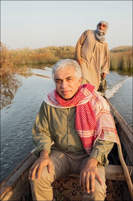
With the fall of Hussein’s regime, though, Alwash returned to Iraq in 2003 — after 25 years — to find a salt dessert where thriving marshes once stood. Horrified by the destruction, Alwash dedicated himself to bringing back the serene marshes that he remembered from childhood. Alwash and a team of global experts worked with local marsh dwellers to break Hussein’s dykes and canals. The team also worked to integrate marsh management into local agriculture and fishing practices. With help from researchers at Basrah University, they also built a database of environmental statistics on Iraq.
Alwash said he was elated by the announcement that the marshes had finally become Iraq’s first national park. When asked if the park’s creation was difficult, he laughed.
“That would be the understatement of the year,” Alwash said. “It started in 2005, and I thought it would be a matter of a year, maybe a year and a half. It has been almost eight years in the making…what takes one month elsewhere takes one year in Iraq.”
Alwash now wants to share this idyllic garden with the world. He hopes that the marshes will become a top global eco-tourism destination.
“Any self-respecting birder will have to include the marshes on their bucket list,” Alwash said eagerly. “There are 25,000 registered archeological sites in Iraq; about 20 percent of them are in and around the marshes. So I see a future where people can mix kayaking, bird-watching, fishing, and visits to the sites of [Iraq’s] ancient civilization.”
How Much Has Recovered?
Estimates of marsh size vary due to seasonal variations in water levels and differences between drought and wet years, and this variation complicates assessments of exactly how much of the marshes have been restored.
On the high end, international media sources report the original size of the marshes in the 1960s to have been between 15,000 and 20,000 square kilometers (5,800 and 7,700 square miles). Alternatively, the Canadian International Development Agency’s Canada-Iraq Marshland Initiative estimates original marsh size to have been 10,500 square kilometers (4,050 square miles), based on the first satellite image of the marshes taken in 1973. To complicate the picture even further, a 2011 United Nations report defines the physical extent of the marshes as 7,875 square kilometers (3,040 square miles) in 1983, and this represents the area that the Iraqi government has proposed to restore.
Media reports estimate that, after Saddam Hussein had completed his engineering works, the size of the marshes decreased to less than 10 percent of their original size, but approximations of the physical size of the marshes at this time range from 1,000 square kilometers (386 square miles) to less than 2,000 square kilometers (770 square miles).
Adding to the confusion is what happened after restoration efforts started at the turn of the century: satellite images from 2003 to 2006 — when the destruction of Hussein’s dams combined with wet climatic conditions to re-flood large portions of the marshes — gave an overly optimistic picture of marsh health. Then, between 2008 and 2010, drought conditions once again shrank the marsh size.
When asked about the current status of the marshes, Alwash uses the baseline marsh size of 5,600 square kilometers (2,160 square miles) and estimates that roughly 60 percent of that baseline marsh, or 3,360 square kilometers (1,300 square miles), have been restored. Iraq’s Center for Restoration of Iraqi Marshes and Wetlands (CRIMW) use 5,600 square kilometers as the area that Iraq plans to re-flood.
Keith Holmes, scientist at the Spatial Pattern Analysis and Research Laboratory at Canada’s University of Victoria, believes 60 percent recovery may be misleadingly optimistic, especially when considering the 1973 marsh extent of 10,500 square kilometers or the even larger 1960s estimate of 20,000 square kilometer.
“I think they are being rather generous to what is deemed as recovered,” Holmes told Circle of Blue. “I would say it is between 30 and 40 percent of the 10,500-square-kilometer mark… Some flood years may temporarily skew the numbers, but long-term viable freshwater marsh habitat is going to remain less than 4,000 square kilometers (1,540 square miles).”
Some hydrological changes along the Tigris-Euphrates River System are harder to reverse than Saddam Hussein’s dykes and canals. Iraq’s culturally and biologically important marshes are just one component of a highly interlinked river system. Dams and irrigation practices upstream in Turkey and Syria have taken their toll by interrupting seasonal floods, increasing the salinity of the water, and limiting marsh-restoration efforts. These manmade changes not only trickle down to threaten marsh ecosystems in Iraq; they also affect marine ecosystems in the Persian Gulf.
According to a 2010 report by the Canada-Iraq Marsh Initiative, 36 dams in Iraq, Iran, Syria, and Turkey operate in the Tigris-Euphrates Basin. Construction of another 21 dams is planned for the next decade.
Dr. Steve Lonergan, a geographer at Canada’s University of Victoria who headed the Canada-Iraq Marsh Initiative that Holmes worked on, told Circle of Blue that he sees no way the marshes can be restored to 60 to 75 percent of 1973 levels.
“There simply just isn’t the water necessary to restore the marshes,” Lonergan said. “It is being withdrawn upstream by Iraq (for agriculture), Turkey, and Syria (and, to a lesser extent, Iran)… If there ain’t the water, there ain’t a marsh.”
The Missing Drumbeat
For 7,000 years, a seasonal flood has fertilized crops along the Tigris and Euphrates, propelling the development of great civilizations. But the flood has stopped in recent years, which Alwash argues will not only change the biodiversity of the marshes and harm the Goliath heron and the smooth-coated otter that live there, but the lack of flooding will also affect agriculture and the human communities that depend on these rivers.
An April 2010 brief from the United States Institute for Peace outlines the political, economic, and ecological consequences of poor water management in the Tigris-Euphrates River Basin. “Left without sufficient water for irrigation, southern Iraq’s fragile agricultural sector has produced a record low wheat crop, and thousands of Marsh Arabs have abandoned their farms.”
“The whole ecology [of the region] revolves around the flood in the spring — it pushes away the brackish water that accumulates from evaporation the year before,” Alwash explained. “It widens the natural extent of the marshes and deepens the water just in time for the fish to spawn, for the birds to migrate, for the reeds to emerge from winter hibernations. It is what I call a symphony of biodiversity. And the flood is the drumbeat; the annual drumbeat that beats on… and the dams upstream have halted the flooding pulse.”
As much as the absence of floods hinders marsh-restoration efforts, however, Alwash sees a more alarming problem: how the missing flood affects agriculture. Alwash says that the marshes will likely adapt to the environmental damage, since reeds can grow in brackish water. What cannot grow in salty water, however, is the cultivated rice that feeds the people of the marshes.
“I believe the lack of cooperation [over upstream dams] will end in 20 to 30 years in the death of agriculture in the land where it was born,” Alwash said. “Iraq being at the downstream end, it will be the first country to starve.”
Blue Economic Revolution
The shadow of agricultural collapse, however, will only loom over the river basin in the absence of cooperation. Alwash believes that, rather than a point of tension, water can be a “medium of healing” that lubricates cooperative processes in the region. He calls this the “Blue Revolution.”
“My advice to the Iraq government is to stop claiming its historical right for this water,” Alwash said. “Stop complaining about Turkish dams, and start cooperating to come up with economic models that help [both] Iraq and Turkey to use water more efficiently and [in ways that] benefit both peoples at the same time.”
The key is mutual economic gain: Alwash maintains that transboundary cooperation would be easier if leaders can shift the discussion from the realm of politics to the realm of economics.
For instance, under potential cooperative agreements, Alwash said, upstream dams could supply electricity to the entire region and power regional development. Moreover, improved irrigation practices along the entire basin could improve land productivity, reduce water usage, and cut salty agricultural runoff — which turns clean river water into unusable brackish water — to almost zero.
An in-depth 2012 study from the Stockholm International Water Institute (SIWI) models the benefits of cooperation along the Tigris-Euphrates River Basin. The findings support Alwash’s assessment.
“A cooperative approach to managing the water resources is necessary to secure future benefits from the water resources and to maintain peace, stability, and support socio-economic development in the region,” wrote the study’s authors.
Of course, the process will be difficult in a region so full of simmering political tensions, but Alwash sees Europe as an example of how warring nations can come together.
“If Europe can create the common market within a decade after World War II, despite the distrust that has existed there for hundreds of years, I’d say there is hope for bridging the distrust, bridging the problems, and coming to an agreement,” said Alwash, who will soon publish an article in Scientific American outlining his ideas for cooperation between Iraq and Turkey. When asked if his ideas can be applied to other choke points around the world, Alwash responded that he believes so.
“I am sure that, with some tweaking, ideas can cross borders,” he said.
Joanne (Yuan) Yao, a PhD student in International Relations at the London School of Economics (LSE), is currently interning with Circle of Blue. She holds degrees from the University of Chicago and Johns Hopkins SAIS. Her dissertation focuses on cooperative institutions that govern transboundary rivers. Map produced by Kalin Wood, a Washington, D.C.-based former Circle of Blue intern who now works for LivingSocial. Special thanks to Weston Anderson, a senior research assistant at the International Food Policy Research Institute in Washington, D.C., for his help with GIS maps.
Circle of Blue provides relevant, reliable, and actionable on-the-ground information about the world’s resource crises.






Trackbacks & Pingbacks
[…] The marshes, which covered 3,500 square miles in the 1970s, shrank to 290 square miles by 2002. The lush and fertile region evaporated, transforming Iraq into a barren desert […]
Leave a Reply
Want to join the discussion?Feel free to contribute!