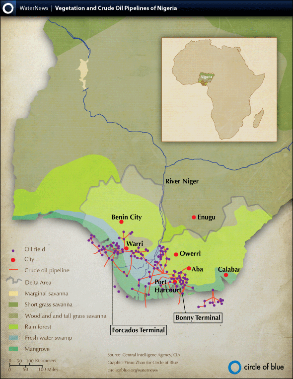
Map: Oil Pipelines and Vegetation in the Niger Delta
Nigeria has been pumping vast amounts of oil since the 1950s. This map shows the oil fields, pipelines, and terminals in relation to the Niger Delta’s main cities and its differing types of vegetation, from swamplands to rainforests.
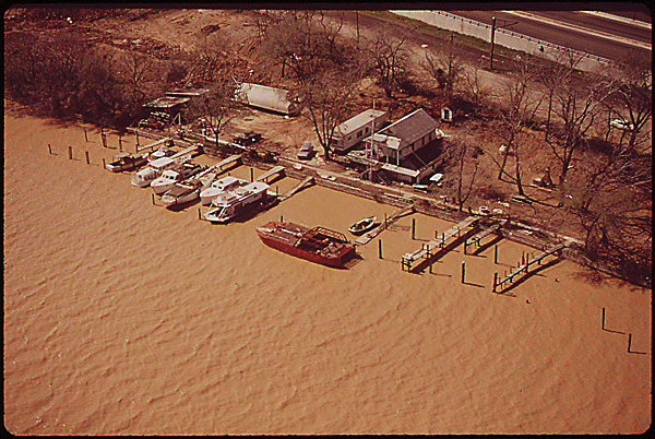
The lives of tens of thousands of Niger Delta residents are endangered by the fierce armed clash between an aggressive guerrilla militia and the Nigerian military over control of the nation’s oil wealth. But as residents have been forced to evacuate their homes and trek through one of the world’s largest wetlands — now monumentally contaminated with oilfield wastes — their lives are also threatened by the toxins, industrial wastes, and oil slicks that are poisoning their drinking water and contaminating the fish they rely on for food.
Just one drop of oil makes 25 liters (6.6 gallons) of water undrinkable, and more than 9 million barrels of oil have been spilled in the Delta over the past 60 years. Check out the map below for more details on how Nigerian power, poverty, and pollution go hand in hand.
This infographic was made to accompany an article by Circle of Blue reporter Aubrey Ann Parker: War on Water: A Clash Over Oil, Power and Poverty in the Niger Delta. Parker is an undergraduate student at the University of Michigan and Yiruo Zhao is an undergraduate student at Grand Valley State University. Both are interns at Circle of Blue, where they specialize in data visualization and design, respectively. Reach Parker at circleofblue.org/contact.
Circle of Blue provides relevant, reliable, and actionable on-the-ground information about the world’s resource crises.


Hello,
I am an undergraduate student in my senor year at NYU studying sustainable urban environments. This semester I am taking my capstone class and I chose to study the Niger Delta. The purpose of my project is to create visualizations & infographics by collecting data from Shell on oil spills and putting them in geographical information systems (GIS), creating a website that will have data visualization and display whats happening in the Niger delta.I wanted to know if you had any data available on the Niger data on oil, gas flaring, social , or infrastructure such as crude oil oil pipelines and oil field locations. Or if you can share the data from this map that would really help. I really appreciate your help. Thank you!
Rosa P.