X-Rays Mark the Spot to Drill for Water in Chad
Magnetic imaging lets scientists peer beneath the surface to see exactly where groundwater sources are located.

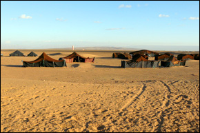
A Bedouin Camp in the Sahara near Tinfou, Morocco.
Scientists in the Sahara desert are using magnetic imaging techniques to save time and money when drilling wells, IRIN News reports.
Hydrologists and geologists working in areas of eastern Chad are trying to find new water sources to keep up with demand. In recent years roughly 300,000 refugees have arrived from Sudan and the Central African Republic straining already limited water supplies.
New techniques are making locating productive aquifers easier, such as magnetic resonance sounding (MRS), which uses magnetic pulses to draw an accurate picture of an aquifer’s size and permeability. The process does not rely on drilling, core samples or other intrusive methods.
“[Magnetic resonance sounding] is direct prospecting, whereas with other geophysical studies we get indirect signs on whether or not there is water. Here, a sign of water means there is water, which means less unnecessary drilling,” said Pierre Michel Vincent, a hydrologist working in Chad, to IRIN.
IRIS Instruments, a French geotechnical company, manufactures the units being used in Chad. IRIS President Jean Bertrand said that MRS makes sense for areas in which the search for water is difficult.
“If you can cure an illness with an aspirin, then there is no need to order the x-ray,” Bertrand told IRIN. “But with worsening water shortages, different techniques need to be considered. The challenge and goal of groundwater exploration is to use the least amount of money to find as much water as possible.”
Bertrand said groups in Algeria, Burkina Faso, Mauritania, Morocco, Mozambique, Niger and several other African countries have purchased the equipment recently.
The cost of the unit–$US180,000–and its weight–350 kg–may make it most suitable for government ministries or relief agencies with deep pockets. But a bigger drawback, however, is the unit’s range. The magnetic signal can penetrate only 150 meters into the ground, rendering it ineffective in places where the water table has fallen precipitously.
It is this problem of groundwater depletion that is the focus of another high-tech water tool. NASA is operating a satellite mission called the Gravity Recovery and Climate Experiment (GRACE) to map fluctuations in aquifer levels.
GRACE satellites monitor Earth’s gravity field for changes caused by the movement of water as it cycles through land, ocean and atmosphere. The moving water alters the distribution of Earth’s mass, which is reflected in shifts in the strength of its gravitational pull. These changes are recorded as the increase or decrease in the distance between two GRACE satellites orbiting in tandem. NASA scientists translate the push and pull data into maps showing monthly changes in groundwater storage.
GRACE missions over India and California have shown groundwater being pumped unsustainably, primarily in agricultural areas where the water is used for irrigation.
Brett writes about agriculture, energy, infrastructure, and the politics and economics of water in the United States. He also writes the Federal Water Tap, Circle of Blue’s weekly digest of U.S. government water news. He is the winner of two Society of Environmental Journalists reporting awards, one of the top honors in American environmental journalism: first place for explanatory reporting for a series on septic system pollution in the United States(2016) and third place for beat reporting in a small market (2014). He received the Sierra Club’s Distinguished Service Award in 2018. Brett lives in Seattle, where he hikes the mountains and bakes pies. Contact Brett Walton


This post is quite amazing and easy to read thanks for sharing this one.