NASA Satellite Photos Capture a Decade of Land and Water Changes
Images show annual variations in Arctic ice, drought conditions in Australia and the decline of the Aral Sea, among others.
As part of its 10-year anniversary, NASA’s Earth Observatory has compiled a gallery of images showing annual changes in the Earth’s land, water and atmosphere in places such as Central Asia, Australia, Iraq and the Amazon.
Photos of the Aral Sea reveal the near-complete evaporation of what was once the world’s fourth-largest inland water body. The southern section of the sea is now a slim finger of water at the western margin of its former boundary.
A dike built in 2005 cut off the flow of water between the two sections, saving the northern part, but dooming the southern. The Amu Darya River used to flow into the southern section, but its entire flow is diverted before it can reach the sea.
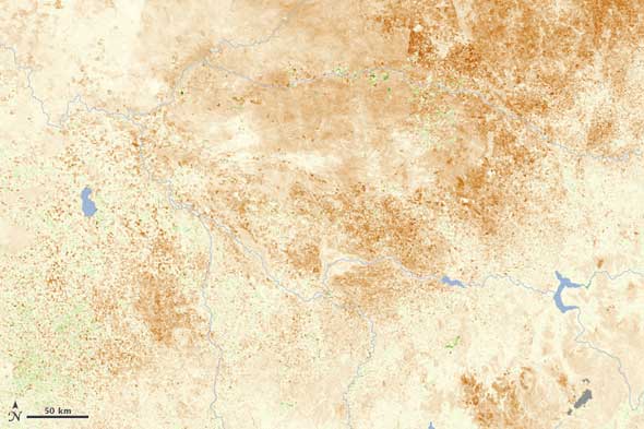
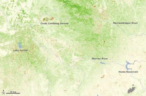
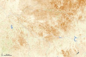
A different kind of dry appears in the satellite images of Australia. The photo series shows how the decade-long drought has affected vegetation in the southeastern states of Victoria and New South Wales. Above-average growing conditions in the early 2000s have given way to large areas of brown in agricultural areas along the River Murray.
NASA satellites also captured land use changes in Iraq and the Amazon.
The marshes of southern Iraq where the Tigris and Euphrates meet were once a lush area of biodiversity. Engineering projects built upstream in the latter half of the twentieth-century caused the marshes to shrink. In the 1990s Saddam Hussein drained the marshes to punish the people living there for taking part in a rebellion.
Images show dramatic improvement in the region, however, after the U.S. invasion in 2003. The marshes were flooded to restore the ecosystem. Even though 2009 was a dry year, images from the middle years of the decade show the wetlands returning to health. A United Nations Environmental Program study in 2006 concluded that 58 percent of the marshes had been restored.
But restoration is not the case in the Amazon. Satellite photos show the patterns of deforestation in the Brazilian state of Rondonia. Illegal roads provide an artery into the forest. Farmers clear lands on either side of the road, creating a “fishbone” pattern. When the land becomes too degraded for farming, the crops are cleared for cattle grazing.
Source: NASA Earth Observatory
Brett writes about agriculture, energy, infrastructure, and the politics and economics of water in the United States. He also writes the Federal Water Tap, Circle of Blue’s weekly digest of U.S. government water news. He is the winner of two Society of Environmental Journalists reporting awards, one of the top honors in American environmental journalism: first place for explanatory reporting for a series on septic system pollution in the United States(2016) and third place for beat reporting in a small market (2014). He received the Sierra Club’s Distinguished Service Award in 2018. Brett lives in Seattle, where he hikes the mountains and bakes pies. Contact Brett Walton





as per my views i too love to save water.i also want to help people who r suffering from water rroblem, i want to aware people about this-that water is very precious 4 us.i live in amritsar
DEAR SIR
I AM PhD STUDNT IN IRAQ ,I HOPE TO RECEIVE ANY IMAGE SATALAITE TO SOUTHERN PART OF IRAQ BECAUSE I WILL STUDY THE MEANDERS IN TIGRES RIVER BETWEEN KUT HALM AND THE QURNA CITY
IN IRAQ WE DID NOT HAVE ANY NEW IMAGE ABOUT THIS AREA
I WILL STUDY BU THE REMOTE SEINSNG AND GIS
MY SUPERVISOR ASK ME ABOUT THAT
PLEASE HELP ME TO GATE THERE