More Houses Submerged as Water Levels Rise in Pakistan’s Attabad Lake
UPDATE FROM JUNE 7, 2010: Officials have begun blasting boulders to expand the lake’s spillway, but outflow remains slow as glacial melt continues.

With glaical melt increasing the water levels of Pakistan’s Attabad Lake–inundating five houses last week–officials began blasting boulders on Wednesday that were obstructing the water body’s outflow, the Express Tribune reports.
Two days before demolition crews began widening the spillway, Attabad’s levels had increased by eight to 10 inches, according to David Petley, a geography professor at Durham University. Petley, who has researched the area, speculates on his personal blog that the blasting was a test run for more obstructive, yet harder to reach boulders.
Meanwhile, the use of explosives has triggered more landslides.
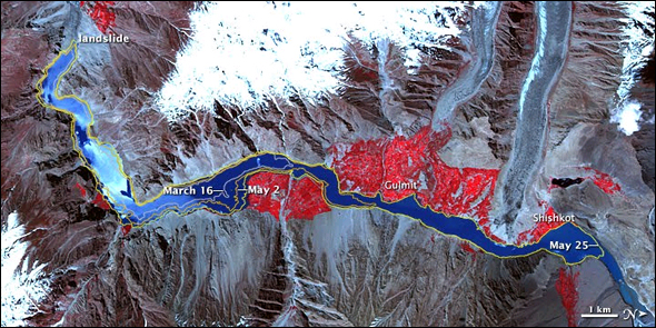
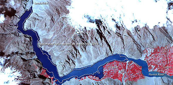
Last month’s glacial melt led to the evacuation of more than 12,000 people living downstream of the landslide-formed Attabad in northern Pakistan, according to the Guardian. An additional 1300 people have already lost a total of 120 houses to flooding as the waters have risen.
Pakistani officials said the danger will be greatest when seasonal rains hit this month, according to the BBC. If the natural dam is breached, as many as 25,000 people in 36 villages could be displaced downstream.

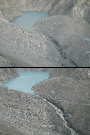
In January, rocks from a landslide formed a natural dam on the River Hunza to produce the 19-kilometer reservoir–a lake that is 100 meters deep and has been increasing at about one-half of a meter per day. Authorities fear that it is within meters of reaching its threshold. In an attempt to convert the impending tidal wave to a moderate-sized flood, the army has built a spillway for the overflow.
The floodwaters and landslide have also blocked the essential Karakoram highway, which links Pakistan with China, closing it indefinitely. Some goods have been loaded in boats and shipped across the lake to offset the nearly $US60 million in trade that has been lost since January, according to the AFP.
According to the Associated Press of Pakistan, the lake levels are being monitored every minute, and “the situation is under control.”
“It is clear that the situation has developed considerably over the last few days,” Petley said on his personal blog. “The flow along the spillway has increased greatly, and the lower part of the channel has widened and deepened. Flow appears to still be controlled by the large boulder in the middle of the channel, although the lowering of the channel downstream will be steadily undercutting this.”
Landslide dams are a recurrent hazard in the Himalaya mountains of southern and central Asia. Sharp hillsides, seasonally heavy precipitation, and high seismic potential contribute to the risk. The last natural dam seen in the Pakistani portion of the Himalayas was formed by a 2005 earthquake–it has still not broken or flooded over. A rock fall in northern India in 1993 completely stopped the flow of the Sutlej River, a main tributary of the Indus, for 30 minutes and partially submerged a dam upstream, halting hydropower electricity generation for months.
Sources: Associated Press of Pakistan, BBC, AFP and
Read Circle of Blue’s initial coverage of the January landslide in Pakistan, and for on-the-ground information, visit Durham University geography professor David Petley’s personal blog.


Leave a Reply
Want to join the discussion?Feel free to contribute!