Great Lakes Ports and Shipping Companies Confounded by Climate Changes and Water Levels
Regional scientists are working on adaptation solutions and planning resilience.
By Keith Schneider
Circle of Blue
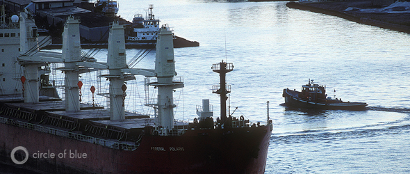
TOLEDO, Ohio — On average, two big ships call every day at the docks of this Lake Erie city. The route to one of the busiest ports in the Great Lakes follows a 34-kilometer (21-mile) ship channel, which starts well out in Lake Erie, runs past the Maumee River delta, and ends 11 kilometers (seven miles) upstream. To ensure the ships do not scrape the bottom of the shallow port at the mouth of the silty Maumee, the U.S. Army Corps of Engineers annually dredges 700,000 cubic meters (900,000 cubic yards) of mud and sand from the channel, or 1 million metric tons a year.
For decades, the mathematics of waterborne transport here were simple. For every 10 to 11 metric tons of cargo that moved into and out of the Toledo port, about one metric ton of sediment left the channel. (Last year, 10.4 million metric tons of cargo were handled at the port.)
But with climate change, the equation is almost certain to get more complex and more expensive, say scientists and port managers. More mid-winter snow melts and rainstorms — and more frequent heavy rainfalls, especially in spring — may lead to higher soil-erosion rates, meaning that Great Lakes rivers are likely to carry more soil into harbors. Higher air temperatures already are warming the Great Lakes, blocking ice from forming, and increasing rates of evaporation that may lead to lower lake levels.
This all equates to more frequent dredging to keep transportation flowing on the Great Lakes. Tens of millions of dollars in Great Lakes port planning and construction depend on a better understanding of weather and water conditions over the next several decades. Tens of billions of dollars in waterborne trade do, as well.
Port Planning in Era of Climate Change
“We’re not in the business of speculating about climate change or its causes,” said Glen Nekvasil, vice president of the Lake Carriers Association, the trade group of U.S. flagged vessels, which is based in Cleveland, Ohio. “We’re just seeing a lot of variability in water levels, and it affects our operations.”
Before the era of climate change — which is widely considered by most scientists to have started around 1970 — weather and precipitation cycles produced somewhat predictable patterns in water temperatures, water levels, and ice formation in the Great Lakes. Over periods that generally lasted 20 to 30 years, the quantity of water in lakes Michigan, Huron, and Superior would slowly ebb and flow, resulting in lake levels that could rise and fall by about 2.1 meters (seven feet). Lakes Erie and Ontario, connected to the bigger lakes, would see corresponding lake level variations of as much as 1.8 meters (six feet).
Managers of the Great Lakes region’s ports worked within these well-understood and extensively documented variations. They developed long-term plans to design and build docks, seawalls, and other transport infrastructure to serve a shipping industry that typically handles nearly 200 million metric tons of cargo annually and employs 226,000 people. There are 110 ports on the Great Lakes and St. Lawrence Seaway, according to the Lake Carriers Association; 32 major ports, including Toledo, handle 70 percent of the cargo and are the central hubs in one of the continent’s most energy-efficient transport systems.
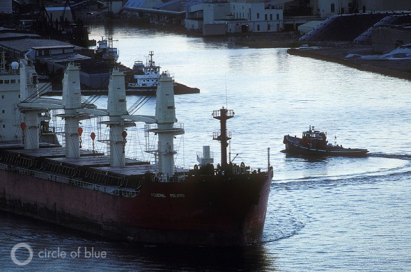
The era of climate change, though, has introduced a new epoch characterized by less predictability. And that could be trouble for the Great Lakes, which lie at the center of a watershed spanning 521,830 square kilometers (201,460 square miles) of land in two countries and which cover 244,160 square kilometers (94,250 square miles) of water surface.
One Lake Tied To The Next
Even before climate patterns began to change, the lakes were so big and so ecologically complex that they already defied neat scientific explanations of how they functioned. The effects of climate change, say scientists, have made the work of predicting the behavior of the Lakes — and thus planning for water transport — increasingly frustrating.
For example, over the last decade, according to a five-year study by the International Joint Commission (IJC) that was completed in March, the volume of water and the water levels in lakes Michigan, Superior, and Huron have been consistently lower than average.
–Victoria Harris
Water Quality & Habitat Outreach
Sea Grant Institute, UW-Green Bay
Dredging operations have not kept pace in many ports, according to Nekvasil of the Lake Carriers Association. Shipping companies, in response, are lightening loads to reduce drafts. On a big Great Lakes ore carrier, every centimeter of lost draft equates to 95 fewer metric tons of cargo (one inch less draft reduces loads by 267 tons), according to the association.
“That’s lost revenue for companies and less efficiency,” Nekvasil told Circle of Blue. “In 1997, when lake levels were high, the biggest ships carried 70,000 tons [64,000 metric tons]. In many ports we’ve lost a foot [31 centimeters] of draft this year. The biggest loads this summer are 64,000 or 65,000 tons [58,000 or 59,000 metric tons].”
Since the upper Great Lakes drain into the two lower lakes, less water in Michigan, Superior, and Huron should translate into diminished flows downstream. But, for some reason, so-called “light loading” is less urgent in the two smaller, lower-level lakes — that same IJC study concluded that lake levels in Erie and Ontario have been higher than average over the last decade and this summer.
“You would expect they would be correlated,” said Eugene Stakhiv, the American co-chair of the International Upper Great Lakes Study and a water resources systems analyst for the U.S. Army Corps of Engineers. “We didn’t find it.”
Changing weather patterns could be a factor, Stakhiv said, and differences in ice formation may also be related. But because the Great Lakes are fed by 123 watersheds, state monitoring programs and climate change models are insufficient to accurately assess and predict how climate change affects any one of them.
To be sure, such uncertainty is not surprising, but efforts are underway to anticipate general responses.
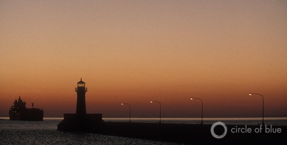
“There is certainly enough scientific data and fact to show that climate change is happening,” said Victoria Harris, the water quality and habitat outreach specialist with the University of Wisconsin’s Sea Grant Institute in Green Bay. “The number of days of ice cover has been and continues to decline. More winter runoff and intense storms are occurring. There are also models being developed based on solid data to predict how some local regions may respond to climate change.”
Climate Change Seen Through A Watery Lens
In the late 1980s, Big Ten university scientists began in earnest to test the theoretical effects of climate change. These earliest diagnoses of changing weather patterns anticipated that the Great Lakes would warm and that water depths could decline. Other potential climate change scenarios for the Great Lakes included the potential for hotter and dryer summers, shorter and warmer winters, longer growing seasons, more erratic spring and fall temperatures, and more frequent and intense storms.
In a region that holds one-fifth of the world’s fresh surface water, the consequences of climate change in almost all of the scenarios involved water — water supply, water quality, water depth, water temperature. Climate change, argued scientists, would almost certainly influence the region’s water cycle and produce changes to precipitation and water supply, all of which are essential to the Great Lakes region’s ecology and economy.
By 2012, a good number of the scenarios look to have become actual events.
Lake Superior, according to the latest evidence, has warmed 2.5 degrees Celsius (4.5 degrees Fahrenheit) since the 1970s. The region’s resorts report that, on average, winter now starts a week to 10 days later than it did in the 1980s and ends a week to 10 days earlier — that is 20 fewer days with snow in a season that typically lasts 100 days or so.
Last year, Wisconsin scientists produced a report asserting that, by mid-century, the summer weather there would be much like summers in Arkansas and Texas today. Meanwhile, extreme weather swings in the spring season are already affecting the other side of the big lake, as temperatures in northern Michigan in mid-March 2012 reached mid-20s Celsius (low-80s Fahrenheit), more than 20 degrees Celsius (40 degrees Fahrenheit) above normal for the region. Yet, this was just one week after an extreme snowstorm dumped nearly 70 centimeters (27 inches) on the region over the course of just 18 hours.
Lamprey Explosion
Other climate change evidence has been more unexpected. Jim Kitchell, a zoology professor at the University of Wisconsin in Madison, is investigating the link between rising temperatures in Lake Superior and the increase in the number of sea lamprey, one of the destructive exotic species that entered the lakes over a century ago through the St. Lawrence Seaway and have been a menace to lake trout and other game fish ever since. The lampreys caused the collapse of the commercial whitefish, chub , and lake trout fisheries in the 1940s and 1950s, ruining fish-related businesses in fishing ports that once thrived, like Leland, Michigan.
“Scientists are documenting evidence of climate change that once were predictions,” said Harris, of the University of Wisconsin Sea Grant Institute. “Climate change is upon us. While scientists are careful not to attribute any particular storm events or seasonal weather patterns to changing climate, they are seeing long-term changes occurring.”
“It’s happening,” she continued, “regardless of what people may think about the causes, and communities need to prepare for the consequences.”
Climate Damage To Ports
Another of the Great Lakes region’s critical sectors affected by climate change is the commercial shipping industry. Shallower water is exposing wooden port structures to the air, vastly accelerating rot that is damaging docks and breakwaters, said Gene Clark, the coastal engineering specialist for the University of Wisconsin’s Sea Grant Institute in Superior. An example, he said, is the port of Washburn, Wisconsin, which just finished a $US 1 million project to rebuild a seawall and dock that were steadily weakened by rot and then wrecked by a 2010 winter storm.
“We’re seeing more rot in these wooden structures, more corrosion in steel pilings, too,” Clark told Circle of Blue. “Several of the ports in Lake Superior are reporting significantly increased levels of corrosion in steel supports for docks that need to be replaced.”
Moreover, increased intense storms could lead to more erosion in watersheds and siltation in ports. Rivers in the Great Lakes Basin deposit 2.3 million cubic meters (3 million cubic yards) of silt annually into the region’s major ports, according to the Lake Carriers Association. And though the Army Corps of Engineers dredges about 1.5 million cubic meters (2 million cubic yards) annually — a little less than half of that dredged from the Toledo ship channel alone, due to the super silty Maumee River — layers of silt are building up in Great Lakes commercial ports and will soon reach 15 million cubic meters (20 million cubic yards).
This could lead to even lighter ship loads and emergency closures of some ports, said Nekvasil of the Lake Carriers Association.
Last December, for instance, the last cargo of coal in 2011 — coming from the American West, loaded on a boat in Lake Superior and destined for the power plant in Holland, Michigan — was cancelled because of sediments that produced shoaling in the port. Shoaling is a sand bar that moves. The coal was instead trucked to Holland. Likewise, mounds of sediments and shallow water also forced St. Joseph, Michigan, to temporarily close its port in December 2011. An emergency dredging operation reopened the channel to ships hauling limestone and other cargo.
“The difficulty is making decisions when specific impacts are uncertain,” said David Bidwell, program manager of the Great Lakes Integrated Sciences and Assessments Center, a federally funded research collaboration between the University of Michigan and Michigan State University. “Planning [in the Great Lakes] has used a 30-year average for climate. Scientists are confident in saying that conditions now and conditions in the [near] future are very likely to be different than they were in the past.”
“We know things have changed and are going to keep changing,” Bidwell continued. “What we see is a movement towards resilience — thinking of infrastructure and systems that work in a broad range of lake levels.”
“Investing in coastal infrastructure that is designed to withstand more extreme highs and lows and more severe and frequent coastal storm and flood events just makes sense,” added Victoria Pebbles, the program director at the Great Lakes Commission, a research group in Ann Arbor, Michigan. “We should be designing 21st century infrastructure that not only accommodates these processes, but uses ecosystem services to build local resiliency and improve environmental quality. For example, coastal wetlands provide many services to communities, from water filtration to flood control. In storm events, they can also buffer against the impacts of wind and waves coming in from the lake.”
Moving Mud in Toledo
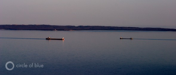
In Toledo, the careful choreography — between ships that carry cargo into port and barges that haul equipment and dredge spoils out of the eight-meter (27-foot) deep channel — describes an essential dance of commerce that is decades old.
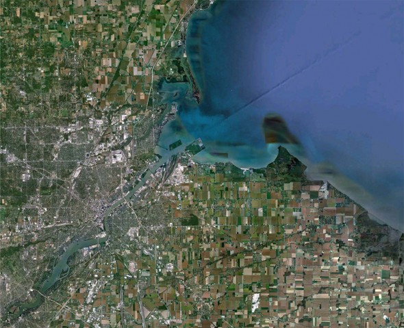
The Maumee River, which drains productive farmland in Ohio and Indiana, carries a huge sediment load, depositing much of it in the Toledo port, at its mouth. This year, said Joe Cappel, the director of cargo development for the Toledo-Lucas County Port Authority, the port could handle 11 million metric tons (12 million tons) of steel, grain, cement, coal, limestone, crushed rocks, chemicals, fuel, and aluminum, representing a 4 percent increase from the cargo volume in 2010.
“The economy is improving,” Cappel told Circle of Blue. “Water levels are good here. We’re not pushing the panic button. The Army Corps is doing what it needs to do to keep the channel open; they’re getting it done.”
J. Carl Ganter is director of Circle of Blue and Aubrey Ann Parker is assistant editor. Both are based out of Traverse City, Michigan, and can be reached at jcarl@circleofblue.org and circleofblue.org/contact.
Circle of Blue’s senior editor and chief correspondent based in Traverse City, Michigan. He has reported on the contest for energy, food, and water in the era of climate change from six continents. Contact
Keith Schneider

