Video: Mapping Grand Traverse Bay with the Great Lakes Water Studies Institute
A narrated photo gallery of a day on the bay.
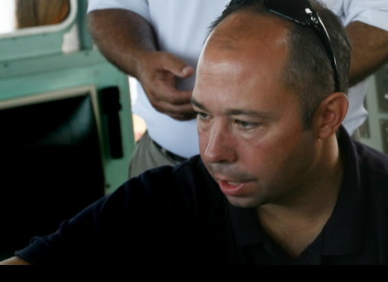
Hans VanSumeren, director of the Water Studies Institute at Northwestern Michigan College in Traverse City, narrates the process of mapping the Grand Traverse Bay with sonar technology.
TRANSCRIPTION
Hans VanSumeren: My name is Hans VanSumeren and I’m the director of the Great Lakes Water Studies Institute at Northwestern Michigan College.
The idea of conducting hydrographic surveys in the bay was something that had not happened in a long long time. This year we’re using Kongsberg’s 3002 multi-beam sonar. It sends out hundreds of beams to the bottom of the lake and each beam is capable of resolving somewhere around 1-2 inches of definition at the bottom. So those 500 beams are spread out over up to 200 degrees of swath, so the deeper you go, the farther that swatch coverage goes. In deeper water we’re actually mapping 600-800 meters across at any one time. As we move through the water and the vessel rolls or pitches or heaves, all that information is fed back into the system so that the information we get from the bottom is all maintained at a real high level of accuracy. This equipment is used all over the world. It creates essentially a motion picture of the bottom, so we’re getting resolution of sand ripples, or bottom features, or drop-offs, or sediment types, or things on the bottom that we simply don’t know about right now.
Through Michigan Sea Grant, through the state DEQ (Department of Environmental Quality) and through the college, we’ve pooled these resources to get this boat operational, to get this equipment up and running, to get students to run the program. So we have 3 student interns onboard today from our Freshwater Studies degree program.
Brent Goggins: My name is Brent Goggins and I’m a part of the freshwater studies program. The most interesting thing for me as far as the most change that has happened is, you know, these quagga mussels and zebra mussels, how much they’ve clarified the water, how much they’ve filtered the plankton out. Clarity went from whatever it was, now we’re down 15 meters and you can see this. It’s ridiculous how clear it is and everybody’s says ‘Oh it’s so beautiful and clear’ but it’s clear for a reason. There’s nothing there.
VanSumeren: We know the quagga mussels are pretty much at all depths of the lakes now. And we’ve seen them in 200, 300, 400 feet of water. But if we start to look at sediment characteristics and then look to see what sediment do they really prefer or not prefer, then we’ll be able to characterize the bay as a whole, and say ok, in these general areas we’re seeing an abundance of quagga mussels or round goby, and in these areas we’re seeing nothing.
Kyle Lalone: Hi, I’m Kyle LaLone from Elk Rapids. I’m in the freshwater studies program. This is an exciting opportunity as far as people can learn and explore what the water can offer and what we can give back to it.
VanSumeren: Last year we found a shipwreck. We had, not this system, but something similar, and we found a shipwreck off of Lee Point that had gone down in 1980 and people had been looking for it for many, many years and had not been able to find it. In terms of this year, we’ll just keep looking for sediment changes in the bottom, unique features at the bottom. After this is all done and the sonar work is done, we’re going to get a remote-operated vehicle and we’re going to drop that submarine down and visually inspect these areas. So anything we find that we don’t know what it is, we’ll put a camera on it and we’ll find out exactly what it is.
Mark Breederland: This is Mark Breederland with Michigan Sea Grant. I’m an extension educator based in Traverse City, Michigan. We’ve pretty much been in the west side of Grand Traverse Bay, but either today or this week we’ll be in the east side of Grand Traverse Bay, which has some very steep topography right off the Old Mission Peninsula. The deepest spot that we know of is about 620 feet in East Grand Traverse Bay off of the Old Mission Harbor. A dream would be actually just getting up to the Straits of Mackinac. It’s such a fascinating spot, where Lake Michigan and Huron naturally come together as a river. I think we’ll see more and more of this type of survey work being done through time.
Heather Rousseau is a photojournalist and former intern for Circle of Blue during the summer of 2010. Read more about Hans VanSumeren and the Water Studies Institute in this article by Circle of Blue’s assistant editor Aubrey Ann Parker: At the Helm of the First U.S. Freshwater Studies Program — Meet Hans VanSumeren. Reach Parker at circleofblue.org/contact.



Leave a Reply
Want to join the discussion?Feel free to contribute!