A Moneyball Approach for Groundwater Monitoring Networks
A U.S. Geological Survey hydrologist shows the way to smarter cuts and better data collection.
By Brett Walton
Circle of Blue
As budget cuts ripple through state and federal governments, water managers have been forced to turn off gauges that monitor rivers and aquifers. They may now have a tool to see them through the cuts without sacrificing the reliability of their networks.
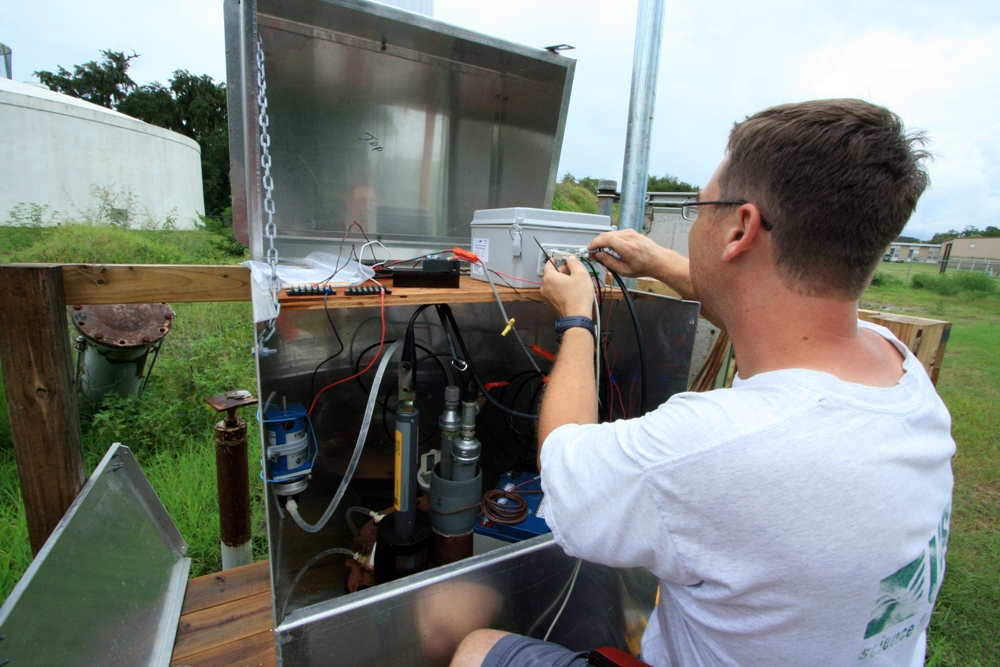
A hydrologist with the U.S. Geological Survey has developed a model that shows which wells can be removed from a groundwater monitoring network while maintaining the network’s ability to produce accurate maps of the water table.
“In a time of belt-tightening we need to make these networks more efficient to save money,” Jason Fisher told Circle of Blue. Fisher works at the USGS’s Idaho National Laboratory project office in southeast Idaho.
The idea behind the model has been used in other fields – in forestry and finance, for example, to cut trees and costs – but less often in the water world. The Kansas Geological Survey used a similar concept in the 1980s to cull its well network. Wayne Bossert, manager of the Northwest Kansas Groundwater Management District, told Circle of Blue that the state was able to reduce the number of wells by a quarter without a reduction in accuracy.
–Jason Fisher, hydrologist
U.S. Geological Survey
Yet in many cases, Fisher said, the decision to eliminate a monitoring well is more art than science.
“Water managers use soft knowledge about the system,” he said. “It’s an intuitive decision about which wells to cut.”
Fisher’s model is a “Moneyball” approach to water data. In sports, the term – from a hit 2003 book about the Oakland Athletics baseball team that was turned into a movie starring Brad Pitt – refers to the statistical methods used by teams with shallow pockets to find players on the cheap whose value had been ignored. For water monitoring, it means pinpointing the stations or wells that add little value to a network and could be eliminated without impairing the quality of the data.
The model is not likely to crack the bestseller lists or rouse the interest of movie studios, but Fisher notes that this analysis should be required reading for any groundwater manager — not just those dealing with the specter of budget cuts.
“If you find wells that are redundant you then have extra money to place wells in other locations,” he said.
Making decisions about where to place the new wells, however, is not something Fisher’s model is designed to do. It identifies which wells to cut, not how to build up the ideal system from scratch. Fisher compared the model’s method to the interaction between chromosomes. The model’s genetic algorithm turns specific wells off and on until it finds the combination that maps the water table without causing the rate of errors to jump.
National and Global Value
Much to the chagrin of scientists and water managers, data collection has taken a hit from federal fiscal austerity. Nearly 250 USGS groundwater monitoring stations have been “recently discontinued,” meaning eliminated within the last year, said Mike Norris, coordinator of the USGS National Streamflow Information Program.
Yet the federal government is not the only prospective client for Fisher’s algorithms. States and water districts often have their own networks, which can be quite extensive. Texas, for example, has roughly 6,000 wells to monitor its aquifers.
Fisher tested his model on two networks in Idaho’s Eastern Snake River Plain Aquifer – a federal-state cooperative network with 166 wells and a USGS-Idaho National Laboratory network with 171 wells. He found that 20 and 40 wells respectively could be removed without diminishing the quality of the networks.
But to complicated matters, water managers usually have several reasons for operating a monitoring network. They might be concerned with changes in water volumes, water quality or the movement of contaminants. Fisher’s model looks at optimizing the performance for just one objective: mapping the water table.
With some adjustments, the model can be used for other objectives such as improving the networks that monitor water quality – and that might be where the bigger cost savings lie.
“You can see huge savings because of not sending unnecessary samples for testing,” he explained.
In particular, Fisher is taking a look at groundwater pollution around Idaho National Laboratory, where he works. The contaminants are a legacy of nuclear experiments done at the lab.
Bossert agrees that setting the proper goal is essential. When Kansas optimized its network in the 1980s, “the largest decision was the desired accuracy of the data,” Bossert wrote in an email to Circle of Blue. The result was a plot of wells that would show regional water trends over decades but without the cluster of detail needed for individual users to make annual management decisions.
Fisher wants his model to flourish. He designed it using open source software so that it is accessible to all.
“My hope is that people will pick this up,” he said. “I hope it goes beyond the Snake River Plain to others around the world.”
Brett writes about agriculture, energy, infrastructure, and the politics and economics of water in the United States. He also writes the Federal Water Tap, Circle of Blue’s weekly digest of U.S. government water news. He is the winner of two Society of Environmental Journalists reporting awards, one of the top honors in American environmental journalism: first place for explanatory reporting for a series on septic system pollution in the United States(2016) and third place for beat reporting in a small market (2014). He received the Sierra Club’s Distinguished Service Award in 2018. Brett lives in Seattle, where he hikes the mountains and bakes pies. Contact Brett Walton




Leave a Reply
Want to join the discussion?Feel free to contribute!