Ogallala Water Data
A clutch of new data tools from Circle of Blue puts the Great Plains’ water crisis into context.

The southern Great Plains are drier now than in the Dust Bowl years of the 1930s. What to do with the Ogallala Aquifer — the largest underground source of fresh water in the United States — is an urgent matter for the farm states of the Great Plains. The aquifer is shrinking, and water districts from Nebraska to the Texas Panhandle have considered plans to slow the rate at which their livelihood is pumped out of the ground.
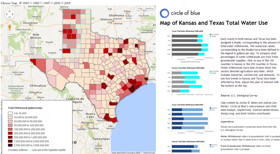
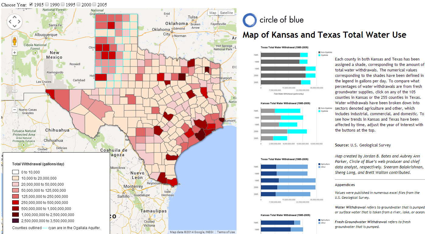
But conservation was dealt a setback last week, when five counties in western Kansas rejected a measure to cut annual water use by 20 percent through 2020. This week, Circle of Blue reports on the failed conservation plan with a new set of data tools, maps, photos, and reporting that put the region’s water crisis into context. Data on crop yields illustrate the importance of irrigation. Charts showing water use by county reveal that 95 percent of fresh groundwater goes to agriculture, while a high-resolution map highlights the water districts that are responding to the challenges.
These tools are part of Choke Point: Index, an investigation into the condition of water resources in three essential American farm regions.
Circle of Blue provides relevant, reliable, and actionable on-the-ground information about the world’s resource crises.


Leave a Reply
Want to join the discussion?Feel free to contribute!