Study: Texas Lost Enough Water in the 2011 Drought to Fill Lake Mead Nearly Twice Over
Most of the water evaporated from soils, according to new research using satellite data.
By Brett Walton
Circle of Blue
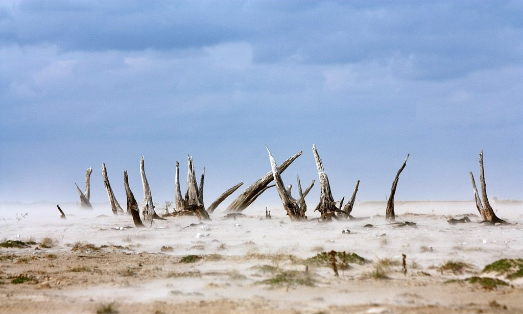
In the historic drought of 2011 fierce heat and record-low precipitation pummeled Texas agriculture and depleted the state’s water supplies to the point that hundreds of towns imposed restrictions and at least one ran out of water.
Combining data from NASA’s GRACE satellite mission with on-the-ground measurements, researchers from the University of Texas have now estimated how much water the state lost that year and from what sources. In doing so, they provide a clearer picture of how drought affects water supplies on a statewide scale and the importance of monitoring systems that can predict drought.
Between February and September of 2011, total water reserves in Texas dropped by 62.3 billion cubic meters (50.5 million acre feet) – nearly enough water to fill Lake Mead, the nation’s largest reservoir, twice over. That amount of water would cover the state of Texas to a depth of 9 centimeters (3.5 inches).
The lion’s share of the decline, some 70 to 80 percent of it, evaporated from soils, according to the study published online last week in the journal Geophysical Research Letters. The rest of the depletion came from groundwater (8 to 16 percent) and reservoirs (about 12 percent).
–Di Long, postdoctoral fellow
University of Texas
“Groundwater depletion can be significant locally. However, by taking Texas as a whole, most water depletion comes from soil moisture during drought,” Di Long, lead author on the paper, told Circle of Blue. Long is a postdoctoral fellow at the Bureau of Economic Geology at the University of Texas.
Precipitation from October 2010 to September 2011 was only 40 percent of the long-term average in Texas and rivers overall flowed at their lowest level since recordkeeping began in 1895.
The lack of water was devastating. Crop failures and culled cattle herds caused more than $US 7 billion in losses for agricultural producers. Some 300 million trees died in the state. Small towns resorted to tanker trucks when reservoirs dried up and lakeside businesses struggled.
A Change in Method
Since launching in 2002, the GRACE satellite mission has become a premiere tool for measuring changes in water reserves across the globe, particularly in places without a network of sensors on the ground. The twin satellites track changes in Earth’s gravity field and translate those into changes in total water storage, a measure that includes snowpack, reservoirs, soil moisture, and groundwater.
To suss out the contributions from each source, the data has to be interpreted in conjunction with on-the-ground measurements or models. In this case, University of Texas researchers found that the land surface models typically used to calculate the amount of water in the top layers of soil were unreliable during extremely wet or dry conditions, such as in 2011.
Instead, the researchers worked with data collected on the ground. They subtracted groundwater and reservoir measurements taken from monitoring networks run by the Texas Water Development Board to discover what share of the total water loss could be pinned on changes to soil moisture.
Because of the uncertainty in the land surface models, and a lack of ground-based soil moisture monitoring, the research team concluded that GRACE’s measurements of total water storage are a more reliable signal for drought.
“We should exercise caution in interpreting the data too much,” said Bridget Scanlon, a senior research scientist at the University of Texas and a co-author on the paper. “But [GRACE] is a very valuable indicator of total water storage.”
Jay Famiglietti, a professor of Earth system science at the University of California, Irvine, told Circle of Blue that the study is excellent, but he would draw his conclusions even broader. The predictive power of GRACE data, he says, means water managers can anticipate drought. The data for Texas show the state’s water reserves declining years before the momentous twist of heat and aridity emerged in 2011.
“Since GRACE includes all water it is a very important indicator, not just for drought, but for flooding and of course for total water availability,” Famiglietti wrote in an email.
On the other hand, some of the models used in the study are known to produce large uncertainties for soil moisture, said Matt Rodell, a hydrologist at NASA’s Goddard Space Flight Center who routinely works with GRACE data.
Scanlon noted that these uncertainties reinforce the study’s conclusion that the raw data on total water storage be used for drought monitoring.
Lone Star Thirst
Water is a statewide concern in Texas. The state water plan, released in 2012, claimed that water demand will increase by 22 percent by 2060 while supply will drop by 10 percent. And during extreme years, as in 2011, supplies can seesaw rapidly.
The additional heat brought by a warming planet will only add to the problem. In an interview in February, John Nielsen-Gammon, the state climatologist, told Circle of Blue that climate change made the drought in Texas worse, by increasing evaporation.
Earlier this year Governor Rick Perry signed a bill that would divert $US 2 billion from surplus oil and gas revenues to help finance water projects. Lawmakers gave the public the final word, though. The voters will have a chance to reject the outlay at the ballot box this November.
Note: This article has been updated since first publication to clarify statements about soil moisture in the computer models.
Brett writes about agriculture, energy, infrastructure, and the politics and economics of water in the United States. He also writes the Federal Water Tap, Circle of Blue’s weekly digest of U.S. government water news. He is the winner of two Society of Environmental Journalists reporting awards, one of the top honors in American environmental journalism: first place for explanatory reporting for a series on septic system pollution in the United States(2016) and third place for beat reporting in a small market (2014). He received the Sierra Club’s Distinguished Service Award in 2018. Brett lives in Seattle, where he hikes the mountains and bakes pies. Contact Brett Walton






Climate change doesn’t just mean record heat. It leads to more extreme storms and droughts, rising sea levels, and threats to our economy and our health. http://clmtr.lt/cb/uwq0bdc