As Snow Survey Reveals Drought Deficit, Californians Take Extraordinary Measures to Cope
Sierra Nevada snowpack, a major part of California’s water supply equation, is near record lows.
By Brett Walton
Circle of Blue
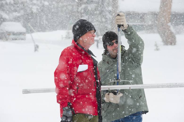
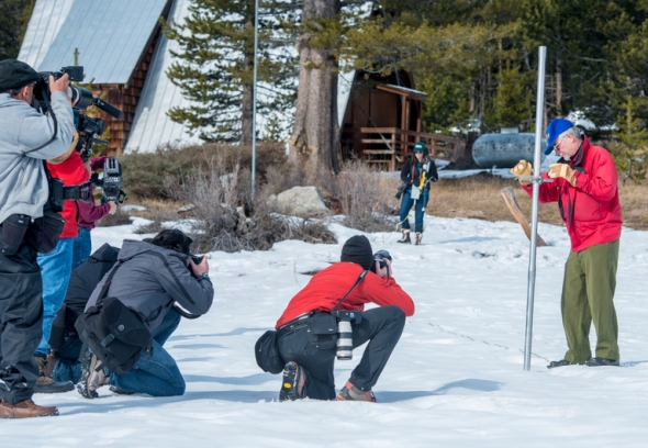
California’s snow reserves are just 32 percent of average, the lowest since 1988 and third lowest on record, according to official state measurements released this afternoon.
The nation’s most populous state is in the third year of a deep drought that is testing its ability to manage scarce water resources for 38 million residents. The drought is also forcing water managers to take extraordinary measures.
“We’re already seeing farmland fallowed and cities scrambling for water supplies,” said Mark Cowin, director of the California Department of Water Resources, in a statement. “We can hope that conditions improve, but time is running out and conservation is the only tool we have against nature’s whim.”
–Mark Cowin, director
California Department of Water Resources
The April 1 snow survey is important because it measures the snowpack at its peak, before the spring melt.
The snow survey, along with a runoff forecast due April 8, also determines how much water will be available through the summer irrigation season. Some 90 percent of California’s precipitation falls between October 1 and the end of March.
The winter of 2013-14 was the hottest on record in California and one of the driest. As a result, both snow levels and reservoirs are well below average. Statewide, reservoirs are just 70 percent of normal, according to a dashboard developed by Qlikview, a data analysis company, and Circle of Blue, using state figures.
The record-smashing weather is prompting some unprecedented responses.
Farmers in the San Joaquin Valley, for instance, are paying record prices, more than $2,100 per acre-foot, for the scant buckets of irrigation water being sold on the market.
Turlock Irrigation District will essentially drain its reservoir in the northern San Joaquin Valley to survive this year, while hoping next winter will be wetter.
And the Department of Water Resources is mulling a plan to use temporary dams to control water quality in the Sacramento-San Joaquin Delta, a threatened ecosystem and a water switchyard for rivers and state canals that supply 25 million people.
Low Snow, High Prices
A series of late-season storms boosted a snowpack that was a frightfully low in January, at just 12 percent of normal. But snow accumulation beyond today is unlikely to occur. April marks end of the wet season and with six dry months ahead, California’s water supply is in perilous condition.
All 58 counties in California are dry. The U.S. Drought Monitor, which produces respected weekly assessments, reckons that 99.8 percent of the state is in drought, and nearly three-quarters in extreme or exceptional drought, the harshest categories.
The pain is being felt most deeply in the San Joaquin Valley, where as many as 800,000 acres of land might go unplanted for a lack of water. Most of the farmers rely on state and federal canals that deliver water from reservoirs in Northern California, hundreds of miles away.
Because the snowpack is so low, San Joaquin Valley farmers will get no water from those canals this year.
Attempting to keep lucrative orchards alive, farmers are paying record prices for water on the market.
On March 14, Madera Irrigation District offered 3,600 acre-feet of water for auction. The high bid was $2,150 per acre-foot, and the average bid was only slightly lower, at $2,061 per acre-foot. (An acre-foot is enough water to cover an acre of land with one foot of water, or 325,851 gallons.)
These are gobsmacking figures for farm water.
Matt Payne, an analyst with WestWater Research, a firm that tracks water markets in the western United States, told Circle of Blue that he has never seen agricultural water prices that high in California, prices that are roughly 50 to 85 times the rates farmers pay for water from federal canals.
Seven buyers, all growing specialty crops such as pistachios, almonds, and tomatoes, purchased the water from Madera, though none of the three buyers Circle of Blue called would comment on the transaction.
Payne said that the deals make financial sense because the amount of water is small and the investment represented by their nut trees is large.
“They can afford to pay that for a small quantity of water because their blended rate ends up being only slightly higher,” Payne said. “It’s worth that investment to keep their trees alive so that they don’t have to replant and incur that cost next year.”
Draining the Reserve
Most of the San Joaquin Valley relies on federal canals for water, but a few districts control their own reservoir. That is the case for Turlock Irrigation District, which owns Don Pedro reservoir.
The recent storms have helped the district, said Calvin Curtin, Turlock’s spokesman. The rain moistened the soil and allowed the district to push back the start of its irrigation season from March 27 to April 10.
–Calvin Curtin, spokesman
Turlock Irrigation District
Don Pedro is just 53 percent of capacity. Still, the 125-year-old district decided to take a risk. Aside from supplies earmarked for river flows, it will use all of its water this year, leaving nothing in reserve for 2015.
It might be the first time the district will ever carry over no irrigation water from one year to the next. Curtin did not know.
“Next year we’ll be completely dependent on rain that we get in the next rainy season,” Curtin told Circle of Blue. “Hypothetically, if we get zero rain, we have zero water to release.”
Monitor and Evaluate
In the Sacramento-San Joaquin Delta, the Department of Water Resources (DWR) is considering temporary dams to prevent saltwater contamination. Water for 25 million people and 3 million acres of farmland flows through the delta.
The rock barriers, used in the 2009 and 1977 droughts, would funnel water from slack backwaters and toward the San Francisco Bay in order to hold back the ocean, which can push farther inland when river flows are so low.
Whether the barriers are built “all depends on the weather,” Mark Holderman, Bay-Delta program manager, told Circle of Blue. The barriers would be removed in the fall.
In addition to those emergency measures, the state will monitor drought hot spots and be ready to assist, Art Inojosa, DWR’s drought intelligence chief, told Circle of Blue.
“We can’t make it rain, but what else can we do?” Inojosa asked, pointing out other forms of intervention.
“If wells are dry and communities have no water supply at all, the state can help truck water in,” he said. “Those are rare cases in small areas but that could be the extreme we might face.”
After all, Marin County, north of San Francisco, was rescued in the 1977 drought by a temporary pipeline that took up the far-right lane of the Richmond-San Rafael Bridge.
Brett writes about agriculture, energy, infrastructure, and the politics and economics of water in the United States. He also writes the Federal Water Tap, Circle of Blue’s weekly digest of U.S. government water news. He is the winner of two Society of Environmental Journalists reporting awards, one of the top honors in American environmental journalism: first place for explanatory reporting for a series on septic system pollution in the United States(2016) and third place for beat reporting in a small market (2014). He received the Sierra Club’s Distinguished Service Award in 2018. Brett lives in Seattle, where he hikes the mountains and bakes pies. Contact Brett Walton




Leave a Reply
Want to join the discussion?Feel free to contribute!