More Trees Mean Less Water for California’s Mountain Rivers
If global warming increases vegetation in high mountain zones, less water might be available for rivers.
By Brett Walton
Circle of Blue
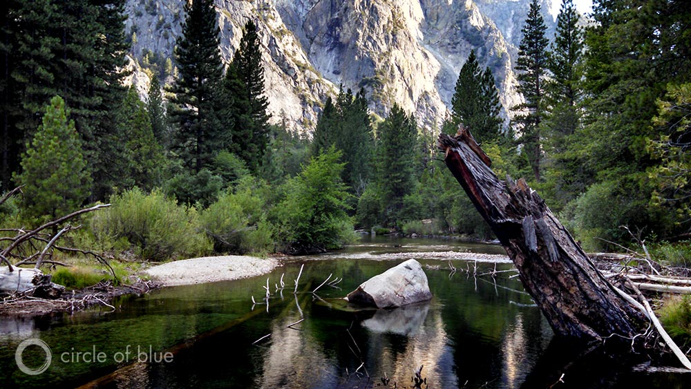
Scientists working in California’s Sierra Nevada mountain range have found a new reason to worry about water availability in the western United States as the planet warms – tree growth.
Climate models predict that southwestern states will become drier in the coming decades and that mountain snowpack, an important natural water bank, will decline. California is now enduring its worst-ever drought. But research published today points out that changes in vegetation will also play a significant role in determining future water supplies.
By the end of the century the amount of water flowing in the Kings River, a basin in the southern Sierra Nevada, could decrease by 26 percent if two things happen: if the local average temperature increases by 4.1 degrees Celsius and if trees, abetted by more clement growing conditions, take root in higher elevations that are currently too cold for dense forest growth. The moisture at these elevations, between 2,400 meters and 3,600 meters, produces most of the water that fills the Kings River.
–Michael Goulden
University of California, Irvine
Warming of only 1.3 degrees Celsius would diminish flows by 9 percent. The temperatures correspond to the most and least severe warming scenarios in the latest United Nations climate report.
The authors of the study, which was published online today in the journal Proceedings of the National Academy of Sciences, argue that the findings can be applied broadly to other basins in which cold temperatures limit plant growth. Yet they also acknowledge many factors – soil quality, seed transportation, and human choices, among others – that could complicate their basic assumptions.
“We assumed that the current forest type moves up,” Michael Goulden, a study author, told Circle of Blue, explaining the genesis of the research. “We said, ‘Let’s see if this is something people need to worry about – if vegetation moves up and matches the current relationship between temperature and forest type.’ Once we make that assumption we get a really big reduction in runoff.”
The heart of the matter are the biophysical processes collectively called evapotranspiration (ET), which refers to the water that is lost from the land surface to the atmosphere because of solar heat (evaporation) or plant growth (transpiration). This is water that will not flow off the mountain and into a local river.
ET is thus one of two variables, along with precipitation, that influences river flows. ET, especially in harsh mountainous terrain where research is more difficult, is not as well understood as precipitation, said Goulden, associate professor of Earth system sciences at the University of California, Irvine.
Most studies that assess future river flows assume that a warmer planet will have little effect on vegetation change and therefore little effect on ET. Goulden’s study, completed with Roger Bales of the University of California, Merced, answers a big question: What happens to rivers if rising temperatures blaze a trail up the mountain that allows forests to spread to new areas?
“I suspect that water managers would say that they already knew this,” Goulden said. “But we did a good job quantifying the effect.”
The Right Recipe for Growth
Goulden and his colleagues were able to pin hard numbers on the changes because the study is based on field measurements.
They used four instruments called eddy covariance towers, which look like radio antennas that rise several meters above the tallest trees. The towers measure wind gusts and water vapor to calculate evaporation rates.
Part of a broader study of the southern Sierra Nevada ecosystem funded by the National Science Foundation, the towers are stationed at intervals of roughly 800 meters in elevation across the Kings River Basin, which places them in different forest environments.
Oak and pine dominate the savannah setting at 405 meters, and Ponderosa pines rule at 1160 meters. The tower at the highest elevation, 2700 meters, is set in a subalpine forest with half the tree cover as the Ponderosa grove.
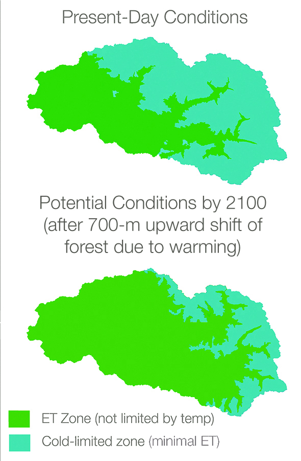
The measurements reveal forest zones that are shaped by temperature and precipitation.
Low ET rates were found at the lowest and highest stations, where vegetation is limited by rainfall and cold weather, respectively. The middle towers are situated in what Julia Jones, professor of geosciences at Oregon State University, calls the “Goldilocks” zone, where moisture and temperature are just right for plant growth.
With more warmth, the Goldilocks zone could move up the mountain, eventually broaching the high-elevation band that accounts for the majority of river runoff from the mountain. Spanning an elevation between 2,400 meters and 3,600 meters, this band generates 68 percent of the runoff into the Kings River, according to the study.
“That’s the zone that’s producing the runoff,” Goulden said.
If a vegetation shift is coupled with a decrease in precipitation, runoff could be even lower. Climate models are uncertain at this point whether California will be wetter or drier in the future, though there will certainly be less snow and more rain.
Goulden and Bales tested the effect of a 5 percent drop in precipitation, which led to a 33 percent decrease in runoff in the harshest climate change scenario, compared to a 26 percent decline looking only at temperature and vegetation.
Jones, the Oregon State professor, told Circle of Blue that the study uses novel measurements to confirm longstanding ideas about forests and hydrology but that more research needs to be done to hone the very basic assumptions about forests marching upward in lockstep with temperature.
“Several questions are raised by these assumptions,” Jones wrote in an email. “What factors control the expansion of forests at high elevation? How much forest expansion is due to the cessation of past management practices, such as grazing in high-elevation meadows? Will climate change be the dominant factor controlling forest expansion, or do other factors, such as soils, occasional freezing events, insects and pathogens also limit forest expansion? Will climate change increase fire frequency, reducing forest cover in some years? So, the prediction is interesting, but there is great uncertainty about how forests will actually change in the next century.”
Goulden acknowledges that scientists do not know the speed and direction of forest change. But, he says, because roughly 4 billion people rely on rivers fed by mountain runoff, it is a worthy line of inquiry that has broad application.
“Tree line is a real phenomenon worldwide caused by cold temperatures,” Goulden said. “If you reduce that cold limitation, it makes sense that vegetation is going to increase and evapotranspiration as well. It seems to me that this is a general finding.”
Brett writes about agriculture, energy, infrastructure, and the politics and economics of water in the United States. He also writes the Federal Water Tap, Circle of Blue’s weekly digest of U.S. government water news. He is the winner of two Society of Environmental Journalists reporting awards, one of the top honors in American environmental journalism: first place for explanatory reporting for a series on septic system pollution in the United States(2016) and third place for beat reporting in a small market (2014). He received the Sierra Club’s Distinguished Service Award in 2018. Brett lives in Seattle, where he hikes the mountains and bakes pies. Contact Brett Walton






Whoa. That is a factor in the water balance equation that I thought would never be venture into. You know that the moisture content of soil, soil porosity, delta temperature and rate of precipitation are factored into how much water reaches rivers from rainfall…but this? Wow. As a fellow water wonk, I loved this piece and think it is fantastic that we get to hear from highly educated and serious data crunchers folks like Goulden (and Bales). I’ll probably re-read this a few times and model their finding a little on my end. Brett, seriously…do you sleep? You’re putting a high-level (no public relations re-write) out every day. You are the best journalist reporting on water issues, and you know that I read them all.