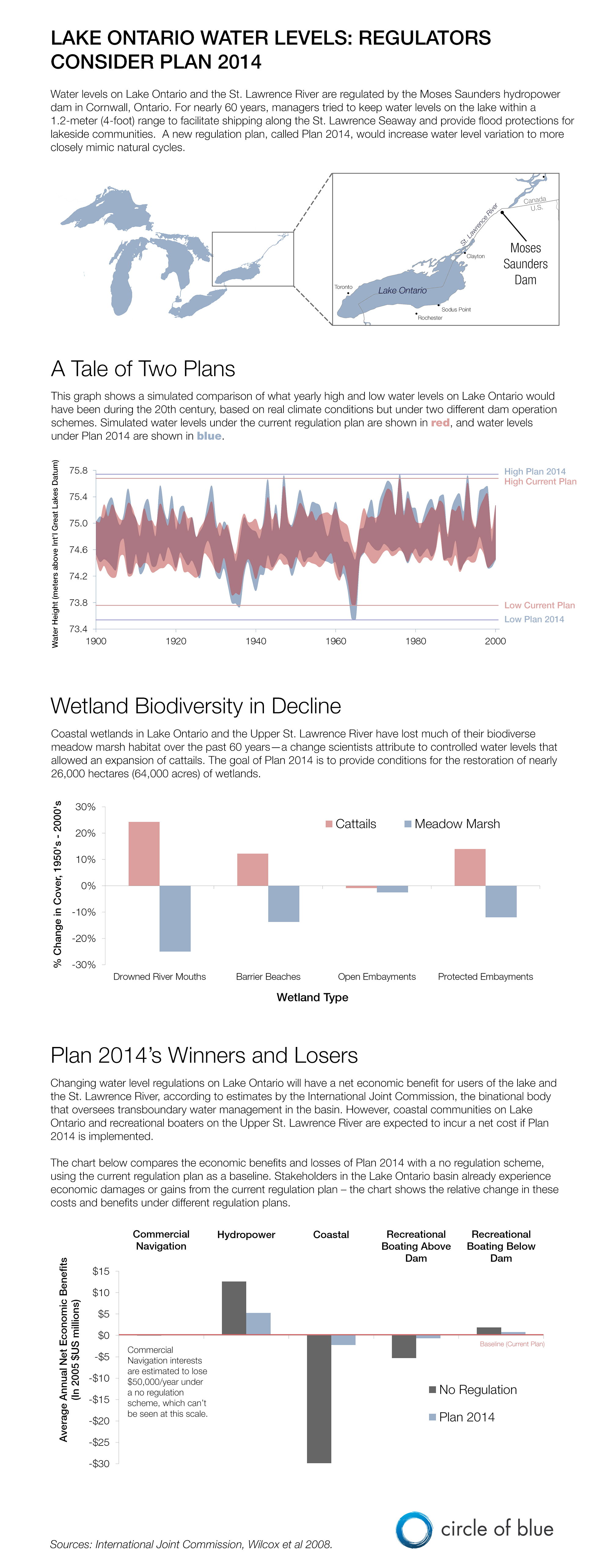
Infographic: Plan to Change Lake Ontario Water Level Regulations Considered by Canada, U.S.
Simulations using 20th-century climate data compare Lake Ontario water levels under Plan 2014 and the current regulation plan.
Plan 2014 is a proposal to change water level regulations on Lake Ontario to help restore coastal wetland biodiversity that has been lost over the past 60 years. The plan is the culmination of more than two decades of research and deliberation, a $US 20 million binational study, and a procession of earlier plans evaluated and discarded in the quest for a perfect balance between shipping, hydropower, municipal, recreational, residential, and environmental interests. Submitted to Canada and the United States by the International Joint Commission last year, Plan 2014 remains quietly stuck in bureaucratic limbo.

This graphic was created to accompany the story: Lake Ontario Water Level Plan Tests Attitudes Toward Environment.
is both a scientist and a journalist, she holds an MS in Environmental Engineering from Michigan Technological University, and she brings proficiency in ESRI’s ArcGIS mapping software.


Leave a Reply
Want to join the discussion?Feel free to contribute!