 https://www.circleofblue.org/wp-content/uploads/2018/11/2017-01-India-Tamil-Nadu-DMalhotra_C4A7610-2500.jpg
1600
2400
Keith Schneider
https://www.circleofblue.org/wp-content/uploads/2018/06/Circle-of-Blue-Water-Speaks-600x139.png
Keith Schneider2018-07-03 15:03:082019-06-24 15:35:12Chennai’s Security Tied to Cleaning Up Its Water
https://www.circleofblue.org/wp-content/uploads/2018/11/2017-01-India-Tamil-Nadu-DMalhotra_C4A7610-2500.jpg
1600
2400
Keith Schneider
https://www.circleofblue.org/wp-content/uploads/2018/06/Circle-of-Blue-Water-Speaks-600x139.png
Keith Schneider2018-07-03 15:03:082019-06-24 15:35:12Chennai’s Security Tied to Cleaning Up Its WaterRampage of Water and Social Entrepreneurs Push Chennai to Consider New Growth Strategy
Online information is changing the conversation about unbridled development
By S. Gopikrishna Warrier, Circle of Blue – May 3, 2017
Before the 2015 floods that drowned Chennai, Pradeep John spent several years posting his thorough and dutifully accurate Tamil Nadu Weatherman updates and alerts on Twitter and Facebook. An amateur meteorologist who developed considerable expertise in weather data and satellite imagery, John’s online followers relied on his crisp forecasts and advice:
“Do not step out unless really necessary,” he wrote in one typical note. “Keep your phones charged, this seems to be a long spell,” he said in another.
The 34-year-old weatherman, though, did not know how popular his reports were until November 15, 2015, during the third of the five spells of year-end torrential rains that killed more than 400 residents and brought the metropolitan region to a standstill for weeks. John received a message that day on WhatsApp. It mentioned “an expert” had predicted more rain. Web traffic monitors indicated that 250,000 people in and around flooded Chennai were following his posts.
“My messages helped people to take immediate decisions,” said John in an interview. “I could tell them which parts of the city would get rain, how long it would last, and how intense it would be.”
In displaying a mastery of new technology and a spirit of breakthrough entrepreneurism John is part of a growing community of savvy young professionals that has helped to spur much of Chennai’s rapid development as a center of information and manufacturing technology. More important than that, though, is how popular online forums in Chennai are helping residents understand how competing trends in hydrology, weather, land use, and development are putting the metropolitan region’s 10 million residents, and many of its businesses at risk. In guiding residents through the complexities of ecology and urban design, the online forums are a new factor pushing city authorities to update Chennai’s growth-at-any-cost development strategy.
John’s work, for instance, bridged the gap between the daily and weekly forecasts that the India Meteorological Department published on its website, and the real-time information needs of those living in Chennai’s most flood-prone neighborhoods. Another group, Citizens Platform, has turned to mapping development patterns around the city’s lakes to deepen understanding of flood-related disasters. The intent is to improve public knowledge about how construction patterns affect drainage.
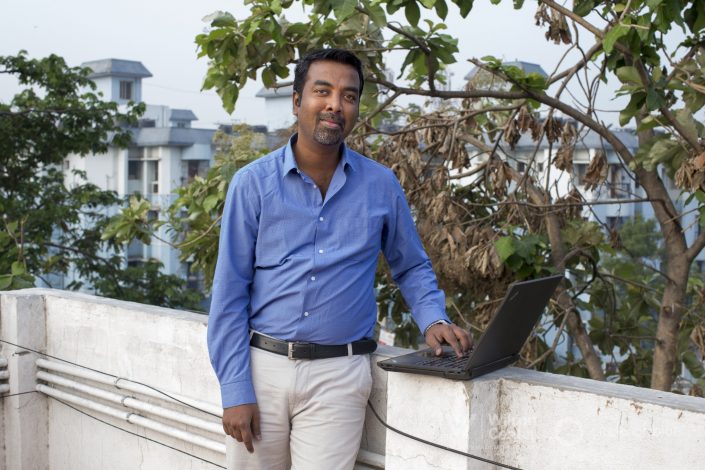
A third group led by Arun Ganesh, a 29-year-old digital mapmaker, developed a street-level map of Chennai and incorporated crowd-sourced information. People reported in from mobile phones about which streets were flooded, and to what depth. The map went live on December 1, 2015. Not only were residents able to avoid the most dangerous flood zones, the city learned which areas were the first to flood and which were worst.
“It was for the first time a street-level disaster mapping exercise was being carried out,” said Ganesh. “Our map was immediately picked up by Chennai residents and at any given time during the floods there were at least 100 people accessing it. Flooding was reported from 15,000 road segments and in the two weeks of its launch it had registered 1.2 million views.”
In displaying command of data gathering and forecasting these and other Web entrepreneurs put residents and city leaders on notice that Chennai’s rambunctious development, which spread across the city’s table flat geography and consumed much of its water-absorbing marshes and natural areas, had become particularly vulnerable to dangerous new climate conditions. Even in a 400-year-old coastal city accustomed to periodic cyclones, as well as wet winters and water-scarce summers, severe weather is pushing the city to embrace new designs for growth that are safer.
“How do we make populations resilient in the face of natural disaster, and how can we best pick up the pieces after disaster strikes?” asked journalist Anjali Vaidya, in an astute article in Dissent Magazine in 2016. “The challenges already facing global civilization—from rising sea levels to drought, fire, and flood, exacerbating human conflict in their wake—threaten to get much worse as temperatures rise, testing our ability to adapt to a changing planet.”
In The Path Of Peril
Located on the eastern seaboard of the Indian peninsula that faces the Bay of Bengal, Chennai is a coastal Asian metropolis that is in the direct path of weather events that are increasing in intensity, according to the regional modeling studies carried out for the Tamil Nadu State Action Plan on Climate Change. The plan projects that the average annual maximum temperature for Tamil Nadu could increase by 3.1 degrees Celsius (5 degrees Fahrenheit) by 2100 from the baseline of 1970-2000. Average annual rainfall, on the other hand, could decline by up to 9 percent. The rainfall pattern could shift and bring more intense cyclones and floods followed by long periods of drought.
The city, as its currently designed, is ill-prepared for such dramatic changes. The 2015 floods and the 2016/2017 drought proved that point. The long period of dry weather has cut water levels in the four reservoirs that serve Chennai – Poondi, Cholavaram, Red Hills and Chembarambakkam. Together they have 1.2 billion cubic feet of water in storage, which is a mere 11 percent of their capacity. Chennai Metrowater, the water utility, supplies less than half of its typical 1.1 million-cubic meter daily supply.
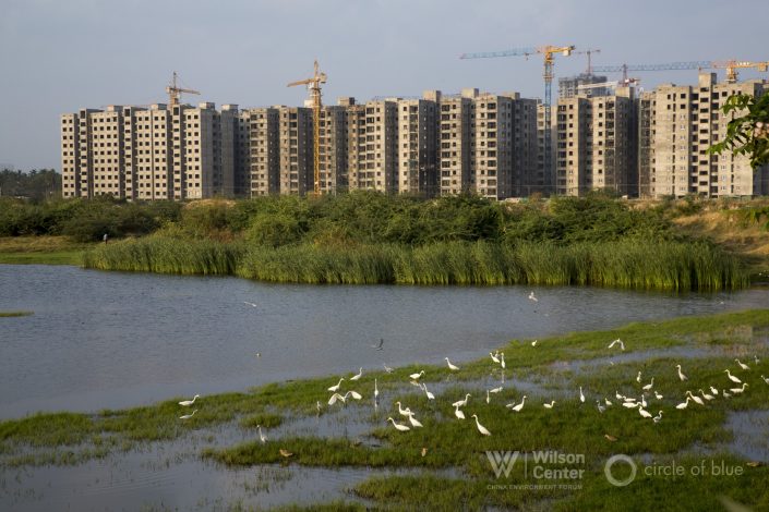
Damage from the flooding is worse. The last major flood in Chennai occurred in 2005. In the decade between the two big floods Chennai changed markedly in two ways. The city’s economic growth engine ran in overdrive. The metro region’s population increased by roughly 250,000 people a year. Entire sections of the city, including the IT corridor in the city’s southern district, replaced water-absorbing marshland and natural areas with pavement and new business and residential construction.
The Pallikarnai Marsh, the city’s largest wetland, was filled in with unplanned construction. The Old Mahabalipuram Road, linking Chennai to the historic town of Mamallapuram, was reclaimed from the adjoining wetlands and turned into an expressway. More office buildings rose along the corridor.
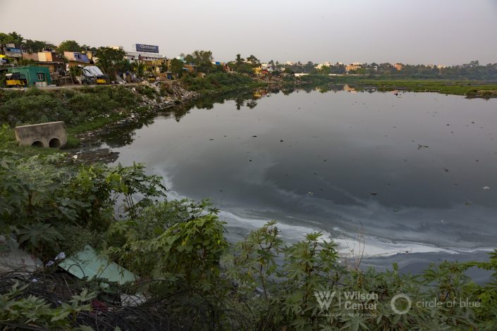
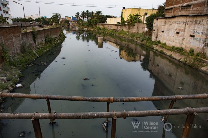
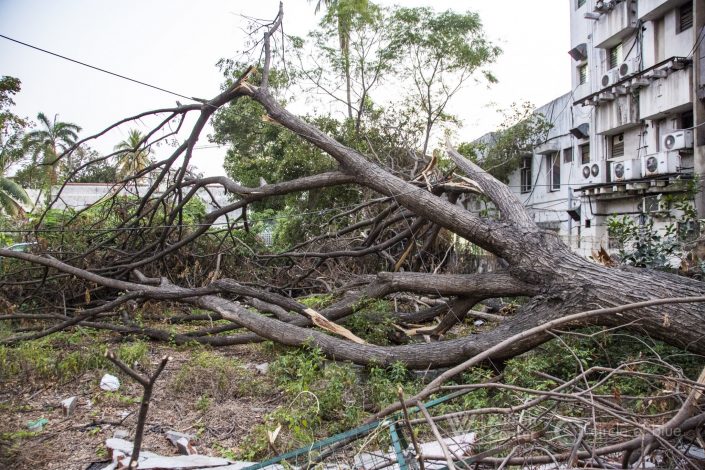
New residents, middle class and poor, crowded into the floodplains of the three rivers that flow from west to east through the city – Kosasthalayar, Cooum and the Adayar. Overburdened sewage treatment plants poured raw wastes into both rivers, filling them with sludges that reduced their drainage capacity. The city’s old and inadequate storm drainage networks overflowed even during modest downpours. When five heavy rainfall events happened between November 8 and December 5, 2015, there was nowhere for the water to flow but into buildings, homes, and the streets. Water at the city’s international airport was so deep that small planes floated away.
Start of A New Operating Strategy
Chennai’s authorities have long been aware of the increasing menace that the disruptive 21st century climate posed for the city. For years they have held periodic public forums, and meetings with academic experts, to consider new ideas for more safely guiding development.
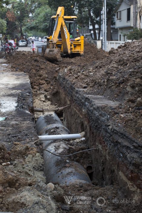
To better manage minor flooding, Chennai is adding modern stormwater drains to its urban drainage network, though the work is expensive and slow.
City leaders embraced desalination to help solve the water scarcity dilemma. Chennai has two operating desalination plants capable of producing about 200,000 cubic meters per day. A third could be completed by 2020, and a fourth is planned.
In order to reduce the demand on fresh water for industrial use, two sewage treatment plants will soon start tertiary treat and convert 45 million liters of wastewater a day (11.8 million gallons) to usable process water for industries.
Chennai also has developed a rainwater collection and storage program and has encouraged water-conserving techniques in construction, and manufacturing. Its big program of replacing conventional lighting with high-efficiency LED street and traffic lights is intended to reduce electric demand from water-wasting coal-fired electrical plants.
Choices that residents are making about where to live, such as in neighborhoods less prone to severe flooding, are aided by construction of a new subway system that opened in 2015. New lines are being added and the $US 2.25 billion system will have 45 kilometers of tracks (28 miles) and 32 stations when it is expected to be completed in 2018.
But city leaders are less enthusiastic about taming Chennai’s sprawling patterns of development, which is making flooding worse. Residents said in interviews that it now only takes a moderate rain to cause storm drains to overflow and for flooding to occur across much of the city.
Online Expertise
That’s where Pradeep John and other Web authorities come in. Their work is helping to elevate the urgency of Chennai’s water logged condition. Flooding alone could cause the city to lose its reputation as one of Asia’s best places to live and do business. The effort of young online Web developers is coaxing government authorities to draw them into vital municipal conversations about the city’s development.
Arun Ganesh, the digital mapmaker, was surprised and thrilled by how online viewers responded to his flood maps. Multiple users reported flooding at different locations in real time. A social media application provided reliable and actionable information in an emergency. The city learned where its flood prevention work needs to improve.
Other online communicators provided guidance to families seeking shelter and food. Divya Ganeshan, a 29-year-old city resident teamed up with her friends to establish a community kitchen for stranded people. Their effort was strengthened by a group of Tamils working in Bengaluru, the capital of neighboring Karnataka, where a call center coordinated relief programs. “The breakthrough during the 2015 floods was that social media became a tool for conveying reliable information,” she said.
Young online communicators proved so effective at setting up informal networks that government officials took notice and got involved. The Bengaluru call center informally blended the efforts of government officials with that of citizen volunteers. P. Manivannan, an Indian Administrative Service officer who was then the managing director of the Karnataka Urban Water Supply and Drainage Board, coordinated the joint efforts. “By using the expertise with the government and the volunteers, we could force multiply the communication and support network with Chennai,” he said.
“The intensity of the 2015 flood and the enormity of efforts that were needed to deal with it brought the citizens out to innovate and find new ways to communicate and support,” said Vaishnavi Jayakumar, co-founder of The Banyan, an established non-governmental organization that works with communities. “We have always been used to the government being in charge and the civil society helping out. In 2015 we realized the government just cannot reach everywhere and the civil society had to move in.”
S. Gopikrishna Warrier, one of India’s most respected environmental journalists, is based in Chennai.
More Choke Point: Tamil Nadu
 https://www.circleofblue.org/wp-content/uploads/2018/11/2017-01-India-Tamil-Nadu-DMalhotra_C4A7610-2500.jpg
1600
2400
Keith Schneider
https://www.circleofblue.org/wp-content/uploads/2018/06/Circle-of-Blue-Water-Speaks-600x139.png
Keith Schneider2018-07-03 15:03:082019-06-24 15:35:12Chennai’s Security Tied to Cleaning Up Its Water
 https://www.circleofblue.org/wp-content/uploads/2017/05/2015-02_C4A4885-DMalhotra-2500-e1498222900407.jpg
1090
2042
Keith Schneider
https://www.circleofblue.org/wp-content/uploads/2018/06/Circle-of-Blue-Water-Speaks-600x139.png
Keith Schneider2017-06-23 08:52:432018-11-29 14:59:30This is Tamil Nadu
 https://www.circleofblue.org/wp-content/uploads/2017/06/2017-01-India-Tamil-Nadu-DMalhotra_C4A5938-2500.jpg
1366
2048
Keith Schneider
https://www.circleofblue.org/wp-content/uploads/2018/06/Circle-of-Blue-Water-Speaks-600x139.png
Keith Schneider2017-06-14 06:42:312017-08-22 12:19:45Mindful of Water Scarcity, Cost, and Pollution, Tamil Nadu Turns to Sun and Wind Power
 https://www.circleofblue.org/wp-content/uploads/2017/06/2017-01-India-Tamil-Nadu-DMalhotra_C4A6606-2500.jpg
1667
2500
Keith Schneider
https://www.circleofblue.org/wp-content/uploads/2018/06/Circle-of-Blue-Water-Speaks-600x139.png
Keith Schneider2017-06-06 15:56:442018-12-04 13:51:22India’s Toxic Trail of Tears
 https://www.circleofblue.org/wp-content/uploads/2017/05/2017-01-India-KSchneider-51530028-logo-2500.jpg
1262
2048
Circle Blue
https://www.circleofblue.org/wp-content/uploads/2018/06/Circle-of-Blue-Water-Speaks-600x139.png
Circle Blue2017-05-31 12:34:282019-04-01 10:41:31Pursuing Riches, Miners Plunder Tamil Nadu’s River Sand
 https://www.circleofblue.org/wp-content/uploads/2017/05/2017-01-India-bottled-water-KSchneider-IMG_6676-logo-2500.jpg
1180
2048
Keith Schneider
https://www.circleofblue.org/wp-content/uploads/2018/06/Circle-of-Blue-Water-Speaks-600x139.png
Keith Schneider2017-05-24 13:12:552018-12-04 11:27:01The Right to Life and Water: Drought and Turmoil for Coke and Pepsi in Tamil Nadu
 https://www.circleofblue.org/wp-content/uploads/2017/05/2017-01-India-Tamil-Nadu-DMalhotra_C4A6151-2500.jpg
1667
2500
Keith Schneider
https://www.circleofblue.org/wp-content/uploads/2018/06/Circle-of-Blue-Water-Speaks-600x139.png
Keith Schneider2017-05-12 07:18:152019-06-24 15:35:29In City Prone to Drought, Chennai’s Water Packagers Rush In
 https://www.circleofblue.org/wp-content/uploads/2017/04/2017-01-India-Tamil-Nadu-DMalhotra_C4A7108-2500-e1493125279687.jpg
620
1600
Circle Blue
https://www.circleofblue.org/wp-content/uploads/2018/06/Circle-of-Blue-Water-Speaks-600x139.png
Circle Blue2017-04-25 07:07:522019-06-24 15:37:01A Torrent of Water and Concrete Imperil Chennai’s IT Boom
 https://www.circleofblue.org/wp-content/uploads/2017/04/2017-01-India-Tamil-Nadu-DMalhotra_C4A5709-2500-1.jpg
1667
2500
Keith Schneider
https://www.circleofblue.org/wp-content/uploads/2018/06/Circle-of-Blue-Water-Speaks-600x139.png
Keith Schneider2017-04-19 12:16:272018-12-03 15:03:56Water Scarcity Causes Cauvery Delta Anguish
 https://www.circleofblue.org/wp-content/uploads/2017/04/2017-01-India-Tamil-Nadu-DMalhotra_C4A5854-2500.jpg
1439
2500
Keith Schneider
https://www.circleofblue.org/wp-content/uploads/2018/06/Circle-of-Blue-Water-Speaks-600x139.png
Keith Schneider2017-04-11 08:41:062018-12-03 14:58:52Chased by Drought, Rising Costs, and Clean Technology, India Pivots on Coal-Fired Power
https://www.circleofblue.org/wp-content/uploads/2017/04/2017-01-India-Tamil-Nadu-DMalhotra_C4A5854-2500.jpg
1439
2500
Keith Schneider
https://www.circleofblue.org/wp-content/uploads/2018/06/Circle-of-Blue-Water-Speaks-600x139.png
Keith Schneider2017-04-11 08:41:062018-12-03 14:58:52Chased by Drought, Rising Costs, and Clean Technology, India Pivots on Coal-Fired PowerThe conflicting demand for water, food, and energy is one of the defining challenges of the 21st century. Global Choke Point, a collaboration between Circle of Blue and the Wilson Center, explores the peril and promise of this nexus with frontline reporting, data, and policy expertise. “Choke Point: Tamil Nadu” is supported by the U.S. Consulate General in Chennai. Jayshree Vencatesan of Care Earth Trust, Nityanand Jayaraman, and Amirtharaj Stephen provided expertise and invaluable guidance.
Sources: Bloomberg New Energy Finance, Central Electricity Authority (India), Circle of Blue, Community Environmental Monitoring, Enerdata, Frankfurt School of Finance and Management, Ministry of Coal (India), Public Finance Public Accountability Collective, The Times of India, U.S. Energy Information Administration, United Nations Environment Program.
Photo Credits: Used with permission courtesy of Dhruv Malhotra/Circle of Blue. Map and Graphics: Used with permission courtesy of Cody Pope/Circle of Blue.
Related
© 2025 Circle of Blue – all rights reserved
Terms of Service | Privacy Policy

