The Next Urban Water Crisis? Inadequate Data Clouds the Forecast
A concrete wall holds back the rising seas from inundating North Jakarta, Indonesia © J. Carl Ganter/circleofblue.org
Risk is not only about geography, researchers say. It’s also about infrastructure, politics, wealth, and demand.
By Brett Walton, Circle of Blue
In Chennai and Harare today, millions of Indians and Zimbabweans find themselves short of water. History, unfortunately, is repeating. São Paulo, in 2014, nearly drained its main reservoir as officials sluggishly responded to a drought. Cape Town came close to doing the same last year when dry weather exposed the fragility of a water system that relied primarily on rainfall.
What is the next center of population and commerce to be roiled by a severely constricted water supply?
It’s an urgent question. Climate change is loosening the bounds of the possible, for both flood and drought. Cities are growing at breakneck pace. Dry taps can trigger disease outbreaks and violent confrontations for scarce water. Shortages erode business confidence and economic output, while adding stress to the lives of residents.
And yet, according to water researchers, advance warning of urban water crises — the failures that could arise in specific cities in the next few months or two years — has proved achingly elusive to forecast globally with analytical rigor and accuracy.
The tools that are in circulation — from organizations like EcoLab, World Resources Institute, Worldwide Fund for Wildlife, and others — do a commendable job, often for businesses, in identifying the geographic contours of risk: where rainfall is low, groundwater is declining, and withdrawals from rivers exceed nature’s contribution. But according to a half-dozen water risk experts interviewed by Circle of Blue, the tools fall short in other ways. They lack more nuanced accounting for cities that would incorporate water use, political dimensions, and the infrastructure that moves water across basins and beneath streets.
The stakes for accurate assessments couldn’t be higher.
“It’s an existential question for cities,” Betsy Otto, director of World Resources Institute’s Global Water Program, told Circle of Blue.
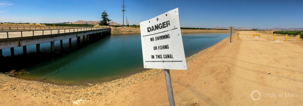
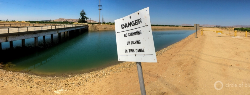
California © J. Carl Ganter/circleofblue.org
Identifying Risk
Otto thinks about water risk in terms of chronic and acute. She likens the distinction to an ill person. Acute risks, like a heart attack that sends someone to the hospital, are an event that requires immediate attention. For a city’s water supply, low reservoirs can be a triggering event.
Chronic risks are those that ultimately give rise to a crisis situation. Basic hydrology is one such factor. Cities in dry areas have a fundamental water supply risk. In other areas, incremental changes in water availability may be a slow-developing vulnerability. That chronic risk, depending on how a city responds to its environment, may not turn into an acute crisis, Otto said. But the risk is present.
Aqueduct, the risk tool developed by World Resources Institute, is designed to identify areas that are exposed to chronic water stress. It is helpful as “an initial screening tool” for chronic risk, Otto said. The latest update, released last week, showed that a quarter of the world’s population, mainly in India, the Middle East, and North Africa, lives in areas of extremely high water stress.
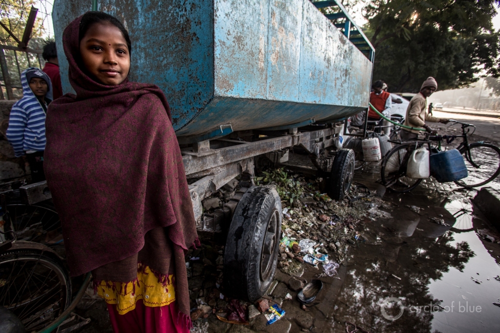
Many residents of Delhi rely on deliveries from water trucks. © J. Carl Ganter/circleofblue.org
What’s Missing from Risk Maps
For all their worth, Aqueduct and the other tools have a number of deficiencies that limit their use, several researchers said. They are not designed to foresee the acute threats: predicting a particular drought in a specific basin, for example.
The difficulty with short-term forecasting is primarily due to the twists of wind, heat, moisture, and the land. Current computer modeling capabilities are not fine-tuned for the complex interactions between water and land that occur over a few months or years. “The chaotic and turbulent nature of weather really makes predictability extremely difficult once you get into those timescales,” Jay Famiglietti, executive director of the Global Institute for Water Security at the University of Saskatchewan, told Circle of Blue.
Inability to predict short-term supply changes is not the only blind spot. Risk forecasting tools generally do not take into account the infrastructure that moves water between basins or augments supplies through recycling or desalination. These investments can buffer a city against the constraints of its physical environment.
Los Angeles, for instance, gets one-third the rainfall of Chennai, but America’s second-largest city did not have to deliver drinking water in tanker trucks during California’s recent severe drought. (Rural communities and ecosystems suffered the most, according to a Public Policy Institute of California assessment, proving the power of that state’s urban areas when it comes to water.) Both Chennai and Los Angeles rate as extremely water stressed on WRI’s Aqueduct tool.
Chennai’s failure, argues Upmanu Lall, a Columbia University engineering professor who works on water risk in India, is that the city allowed its water infrastructure, both natural and manmade, to degrade. Decades of development and urban growth destroyed water-absorbing wetlands while storage tanks were not maintained. Distribution pipes leak water before it reaches homes.
“That’s their problem, fundamentally,” said Lall, who views infrastructure failures as the preeminent water risk. “There’s no shortage of rain. It comes down to bad infrastructure.”
Another shortcoming is data: how much water is used, who is using it, and how much is lost to leaks.
“Invariably the problem we have is we have no ability to forecast demand or even know their demand,” Lall told Circle of Blue. “So in terms of risk, which is the probability of supply falling below demand, we fall short.”
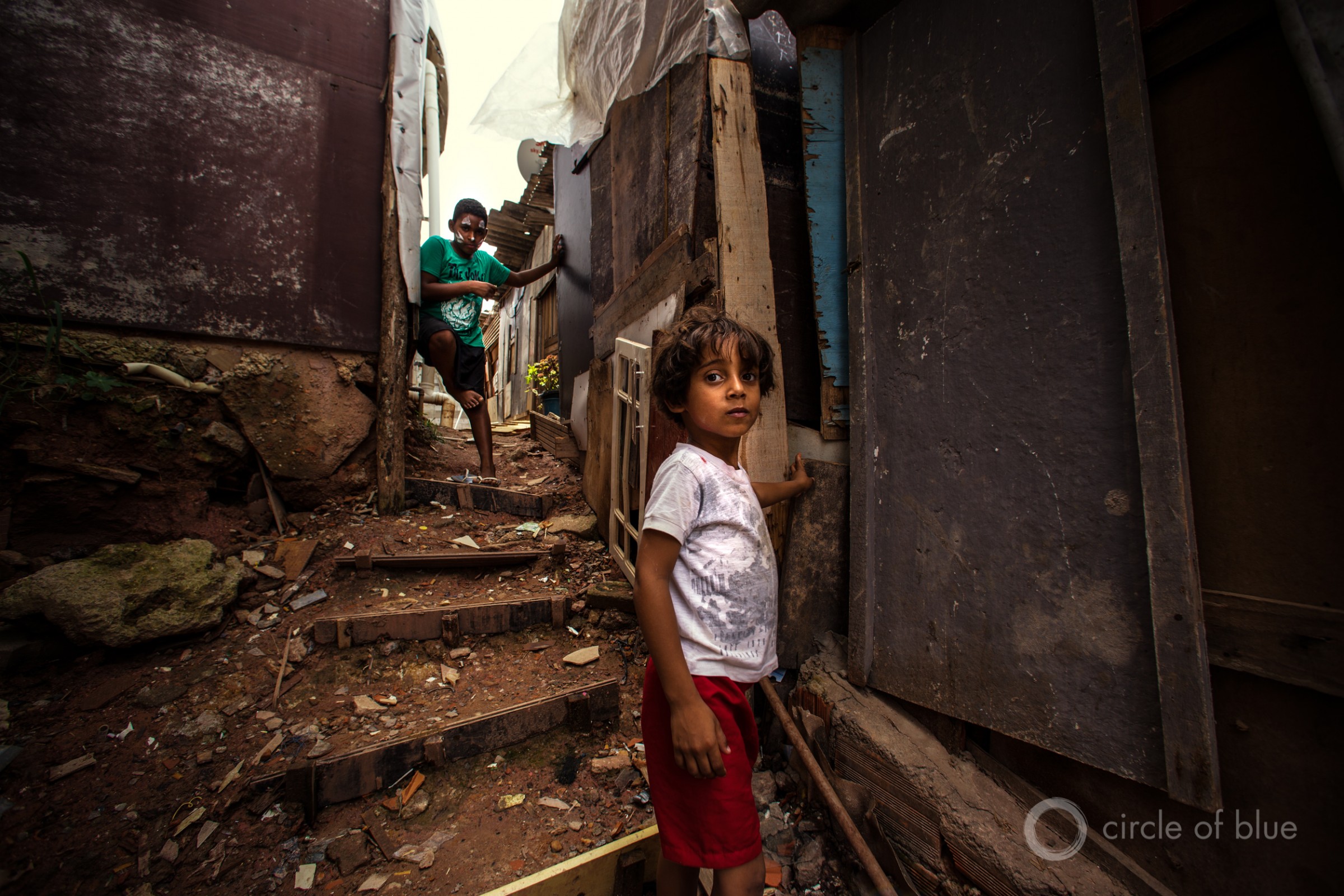
Children play in the alleyways of Sao Paulo’s Portelinha favela, where residents have devised creative ways to channel water and sewage runoff away from their makeshift homes. Here, an old window frame blocks rainwater from flowing into the footpath. Photo © J. Carl Ganter / Circle of Blue
The Political Arena
Current risk tools fall short in ways that go beyond scientific observation and data collection.
“I really do think the problem with risk in cities has much more to do with these other forces that come into play,” Famiglietti said. He then listed common sins against astute water management: corruption, lack of political will, political instability, not understanding the water cycle, not understanding the difference between surface water and groundwater and enshrining that ignorance into policy.
A region’s laws and policies matter when water supplies shrink to the point where there is not enough for all demands. Then water allocation becomes political, said Aaron Salzberg, director of the Water Institute at the University of North Carolina at Chapel Hill. Salzberg used to lead the U.S. State Department’s foreign policy work on water issues.
“How do you manage a political and a social process between competing interest groups to ensure that water is being used in the right way?” Salzberg told Circle of Blue. “And the word ‘right’ becomes really complicated because then is the right way the way that meets the interests and demands of the different constituencies? Or is the right way the technically optimal solution to ensure that you’ve got the water you would need for the uses that are most critical at the right point in time?”
The analytical tools necessary to understand an individual city’s water risk are there, Lall said. But doing the analysis is only half the task.
“Whether someone is acting on it, is a totally different story,” Lall said.
Lall offered an example to illustrate the point. In 2014 a former student of his, a professor at a university in Brasilia, noticed water supply data posted online by São Paulo’s water utility. The rainy season had ended and reservoirs had started to drop.
Lall, notified by his former pupil, watched a crisis unfold in numbers. About six months before the shortages became headline news, the trend lines for São Paulo pointed toward undesirable outcomes. “It was pretty clear to us that these people are going to run out of water pretty soon,” Lall recalled. Yet, remarkably, city officials were not reining in consumption. “Someone knows but no one was doing anything about it,” he remembers thinking.
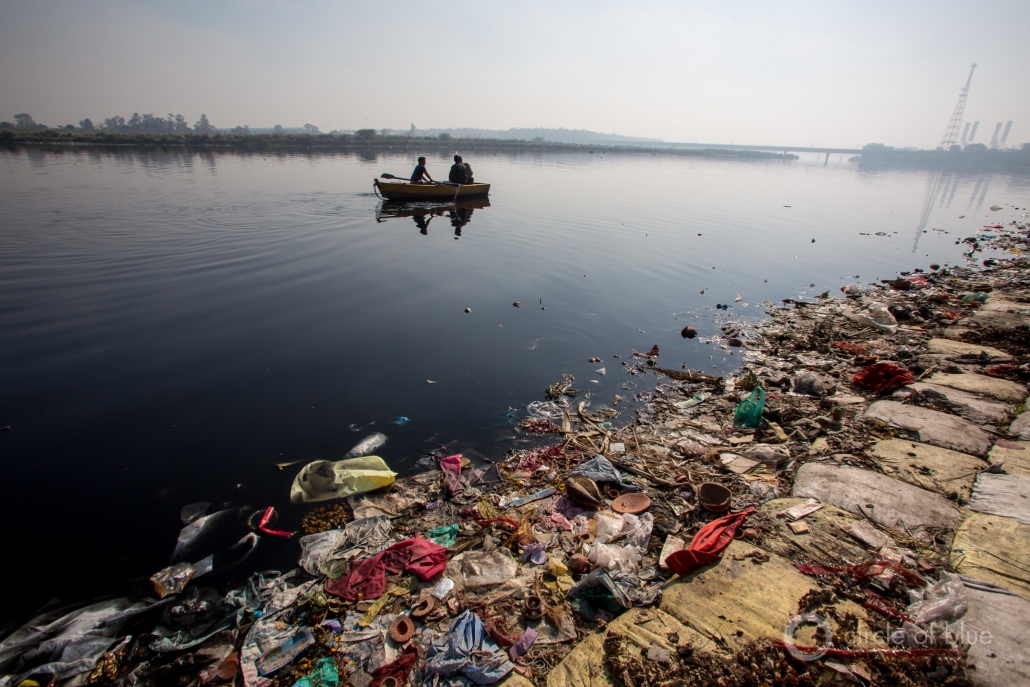
Delhi, India © J Carl Ganter/CircleofBlue.org
Not Being Complacent
Some cities are doing something about it, before a crisis erupts. Many of the elements of water risk assessment, though not available at a global scale, are being incorporated by forward-thinking city authorities and their lieutenants.
Better understanding of a city’s water risks and vulnerabilities is the aim of an intensive planning process developed and shepherded by the global engineering firm Arup and Stockholm International Water Institute. Eight cities, from Mexico City and Miami to Amman and Manchester, so far have completed initial risk assessments, and two have moved to the implementation stage.
The risk assessments include a broad range of factors, said Mark Fletcher of Arup. They look at all the catchments that supply a city with water, not just the basin in which it is located. This accounts for infrastructure that moves water. They analyze land use: Is there much agriculture upstream? Will there be competition with farmers for water? They look at water quality. They catalogue the legal setting: Who has priority to water? They consider local water supply hazards, like saltwater intrusion into Miami’s groundwater or earthquake vulnerability in Mexico City.
Most cities undertake such deep reflection on their water risks, Fletcher said. His goal is to accelerate understanding in order to reduce vulnerability.
“If you take a more comprehensive view of a range of shocks and stressors, a city might be able to come up with responses that cut across risks instead of addressing a single one,” Fletcher told Circle of Blue.
John Matthews, executive director of the Alliance for Global Water Adaptation, advocates for a complimentary approach. Instead of thinking of risk as an all or nothing proposition — crisis, not crisis; stress, not stress — he talks about “risk tolerance.” When does a city start reducing demand? And to whom? What severity of water restrictions are residents willing to tolerate? When are new investments in supply and storage made?
Such a perspective reframes the conversation, Matthews told Circle of Blue. But it also requires civic introspection and a political vision beyond the next election cycle. “It changes it from having a map tell you what you should be worried about to having stakeholders and decision makers say, ‘This is what we’re concerned about. We can live with this level of risk but we can’t live with the threat here.’ There’s usually no map that helps with that.”

Yamuna, India © J. Carl Ganter/CircleofBlue.org
Missing Narratives
There are deeper shades of complexity when looking at the constituencies within cities. London, which appears on some water risk lists because of population growth in southeast England and increasing dryness, has essentially universal piped drinking water service. Karachi, on the other hand, also faces severe water supply constraints. But even on a good day, supply in Karachi currently does not meet demand. Many residents do not have in-home water.
Intra-city equity was a narrative that surfaced in Cape Town’s crisis. What is Day Zero, the day when the taps are dry, to a household in the townships of Gugulethu or Khayelitsha, where fetching water from a community borehole is a daily chore? Life during the city’s water crisis was no different than life any other day, several township residents told Circle of Blue last year. Water restrictions that affected wealthier households and businesses had no bearing for them. Integral to water risk in cities is the question: risk for whom?
Collecting and processing all this information — short-term climate forecasts, changes in demand, local risk preferences, the legal foundation establishing priority to water among different users, the authority to enforce restrictions, the infrastructure that delivers water — can quickly become overwhelming. Still, steps toward that goal are necessary, Otto said.
“There’s no lack of complexity, but that’s not an excuse not to try to understand better what is going on and to plan better,” Otto said. “Too often complexity becomes something we throw our hands up over and we don’t take the actions we can take.”
Were it to exist, even the perfect tool, capturing all of these inputs — “integrating” them in the industry’s lingo — would not be an endpoint, Salzberg argued. For water, as for all things social and political, constant vigilance is required.
“People make this mistake of integrated water resources management and thinking of that as a noun, that it’s an actual thing,” Salzberg said. “But it’s more a way of life and it’s a process. The important thing is that everybody from national governments down to local municipalities, even to regional settings, you need to be working together in a process that’s never ending. This is not problem that we will ever solve.”
Brett writes about agriculture, energy, infrastructure, and the politics and economics of water in the United States. He also writes the Federal Water Tap, Circle of Blue’s weekly digest of U.S. government water news. He is the winner of two Society of Environmental Journalists reporting awards, one of the top honors in American environmental journalism: first place for explanatory reporting for a series on septic system pollution in the United States(2016) and third place for beat reporting in a small market (2014). He received the Sierra Club’s Distinguished Service Award in 2018. Brett lives in Seattle, where he hikes the mountains and bakes pies. Contact Brett Walton



Hi Brett, thanks as always well researched and summarized. Sadly the bottom line will always be dirty corrupt politics and politicians. There is enough technology and tools to allow forecasting with a reasonable amount of foresight. No one acts on it because all action requires more than a five year investment. And unless I can achieve something in my term, that wins me another term. Am NOT committing time effort or resources.Look around, doesn’t matter whether it’s third or first world outcome the same. In fact for most a crisis of this magnitude increases their GDP so lets not worry politics win-win people as always lose-lose