 https://www.circleofblue.org/wp-content/uploads/2020/07/20200729_DRONE_JACOBS_WELL_142-Edit-2500-2-1.jpg
899
1600
Keith Schneider
https://www.circleofblue.org/wp-content/uploads/2018/06/Circle-of-Blue-Water-Speaks-600x139.png
Keith Schneider2020-08-03 06:01:572022-07-08 16:49:24When It Rains, Texas Forgets Drought and Worsening Water Scarcity
https://www.circleofblue.org/wp-content/uploads/2020/07/20200729_DRONE_JACOBS_WELL_142-Edit-2500-2-1.jpg
899
1600
Keith Schneider
https://www.circleofblue.org/wp-content/uploads/2018/06/Circle-of-Blue-Water-Speaks-600x139.png
Keith Schneider2020-08-03 06:01:572022-07-08 16:49:24When It Rains, Texas Forgets Drought and Worsening Water ScarcityBorder Wall Concerns in Lower Rio Grande Valley Diminished By Virus and Growth
Trump Administration Overrides Long-Standing Conservation Mission
August 24, 2020
By Keith Schneider
Circle of Blue
McALLEN, TX – Before it turns right and heads straight north to the Dakotas, US 281 spends its first 46 miles close to the Rio Grande in South Texas. The two-lane highway slips out of downtown Brownsville and bends west through a Lower Rio Grande Valley landscape renowned in Texas for binding water, agriculture, and ecology in a tumult of ferocious urban growth, nationally significant environmental restoration, and political turmoil.
On one side, US 281 passes by fields of cabbage, carrots, and leafy greens, features of a $60 million winter vegetable crop, one of the largest in the country. Although irrigated from the Rio Grande through a 2,000-mile network of canals and pipelines that date to 1904, agriculture in the valley is shrinking. Pressured by two decades of population growth that resulted in 400,000 new residents, the three Texas counties closest to where the river empties into the Gulf of Mexico have annually converted an average of nearly 10 square miles of land into new roads, parking lots, businesses, and residences.
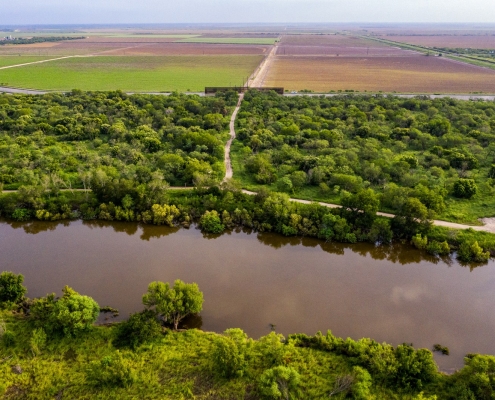
On the highway’s south side, distant stands of spiny hackberry and western soapberry climb out of the shrubs and grass near the river. The thick vegetation is preserved along the U.S. side of the river in a necklace of riparian parcels protected in two national wildlife refuges, five state parks, and several non-profit group conservation areas that extend more than 200 miles upstream from the Gulf of Mexico. Watered by the river, these wildlands of native trees and shrubs lure hundreds of species of song and migrating birds and hide rare four-legged creatures, including the endangered ocelot. The wildlands also attract two-legged creatures. And in the years before the pandemic, some 200,000 visitors per year sustained a recreational tourism economy valued at between $600 million and $700 million annually.
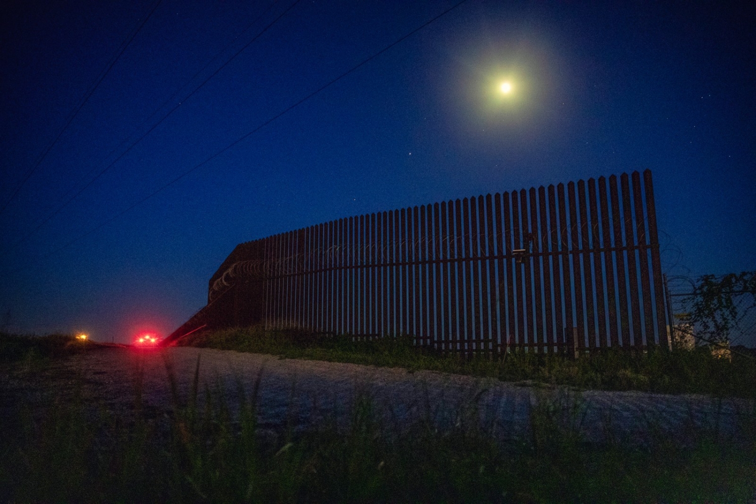
But as US 281 approaches the town of Pharr, where the highway turns north, it opens up to reveal an incongruous steel curtain. The striated structure, about 1,000 feet long and 30 feet tall, with thin gaps where the sun shines through, is the first section of President Trump’s border wall in the Lower Rio Grande Valley.
The United States border wall near the Santa Ana Wildlife Refuge and Highway 281 in South Texas. Photo © Brian Lehmann / Circle of Blue
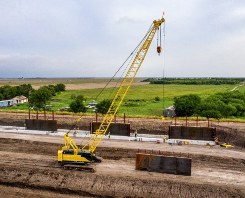
A Section of The Wall Gets Built
For a short time earlier this year, as the section was under construction, the border wall spurred a low-level civic discussion about its benefits or risks. But President Trump’s pet project was not sufficiently imposing to divert attention from the raging pandemic — which has sickened over 46,000 people and killed more than 1,800 in the region – or from the two major issues affecting the Lower Rio Grande Valley this century: population growth and water supply.
The counties closest to where the Rio Grande empties into the Gulf of Mexico — Cameron and Hidalgo — are home to 1.3 million people, nearly 43 percent more than in 2000.
Here’s how the situation lays out in the Lower Rio Grande. With growth has come more urgency about the durability of agriculture and the security of water supplies. Residents and businesses consume about 300,000 acre-feet annually, according to state figures. That is expected to nearly double to 612,000 acre-feet in 2070, when the regional population is projected to soar to more than 4 million, nearly triple the current number of residents.
Most of the surface water consumed in the valley comes from the Rio Grande. Projections in federal and academic studies on climate change predict that water flows in the Rio Grande will shrink and evaporation from large reservoirs upstream will increase.
Underlying the region is a big aquifer. But its waters are salty. Several desalination plants already operate in the valley. A state report three years ago urged municipal water suppliers to consider building many more desalination plants to make the region’s ample supply of salty groundwater potable for drinking.
And because increases in population affect land uses, state planners anticipate many more farms will sell to developers for residences, shopping centers, and roads. By 2070, annual demand for irrigation is anticipated to shrink to 900,000 acre-feet from 1.4 million acre- feet, comparable to the demand in drought years.
That 500,000 acre-foot decline will not be enough to bring water demand into balance with the available supply. By 2070, according to state and regional projections, the region’s total water demand will increase to 1.6 million acre-feet, 200,000 more than this year. And during the next half century freshwater supplies are anticipated to drop.
Summed up. The demand and supply projections mean trouble for the valley later this century, just as it does in much of Texas. The mismatch between fast-rising population growth, increased water demand, and declining freshwater reserves is an endemic challenge across almost all of the state.
Wall Is Not Popular
Given the magnitude of the water challenge, and the encompassing discussion about how to deal with it, the border wall was seen as a little more than a distraction. The president identified the Lower Rio Grande as the site of more apprehensions of immigrants and contraband than any other region of Texas. The wall, he argued, is essential to national security. “We actually have a fantastic design that’s going to be efficient and fast and really, really work well,” he said during a visit to the Lower Rio Grande Valley in January 2019.
Most people did not buy it. Some 75 percent of Lower Rio Grande residents who responded to various opinion polls said the wall will divert river flows, hurt wildlife, and is an eyesore and a waste of money. Lower Rio Grande residents also were exasperated by how the administration undermined long-standing environmental law and policy in order to speed the wall’s construction.
In other words, the border wall was out of place — as an idea and as a piece of structural architecture.
The lone section of the wall along US 281 is hard to miss. It’s a mass of vertical lines in a landscape where most of the visible straight lines — highways and irrigated furrows — are horizontal.
The White House wants hundreds more sections of the wall built, enough to span over 200 miles of along the Rio Grande. It’s not going well, though.
Private landowners along the Lower Rio Grande are holding off the administration’s program of using eminent domain authority to seize land along the wall’s proposed route. The government has acquired just 10 of those miles, seven more than it controlled in December. Should the president lose the election, the border fencing proposal would almost certainly come to a halt.
New and Contentious Discussion
Even before these setbacks, the border wall had unnerved a majority of Lower Rio Grande residents. Bullying private landowners was one issue. Disregarding conservation values that so many Lower Rio Grande residents hold dear was another.
“What’s happening is really sad,” said Jim Chapman, a resident of Weslaco and vice president of Friends of the Wildlife Corridor, a non-profit group that opposes the wall. “In many cases, the wall will slice through refuges, block animals, and ruin the experience people have worked so hard to develop. In a flood, animals won’t be able to escape. The wall will become their death trap.”
Since the 2,088-acre Santa Ana National Wildlife Refuge was established along the river in 1943, presidential administrations of both parties have rallied support in Congress and invested well over $100 million in environmental restoration along the Lower Rio Grande. Most of that money has been spent acquiring 270 parcels of land — 105,000 acres in total — along the U.S. shoreline as habitat for mammals, songbirds, and migrating birds. The Lower Rio Grande Valley National Wildlife Refuge, established in 1979, is responsible for managing most of the ground. The intent is to reverse over a century of human abuse and restore this part of the Rio Grande to some semblance of its natural condition.
Studies by the U.S. Fish and Wildlife Service, a unit of the Department of the Interior, and by other federal and state science groups, show the work has yielded promising results. The two federal refuges support the country’s most diverse communities of song and migrating birds, mammals, reptiles, and butterflies. Scientists have counted 429 species of birds, 44 species of mammals, 115 species of reptiles and amphibians, and 300 species of butterflies.
Previous presidential administrations and Congresses also approved an array of environmental statutes and an international treaty designed to encourage the animals and birds to thrive by securing habitat, protecting endangered species, and safeguarding the country’s most bountiful flyway for migratory birds.
Now, say critics, the White House, the Department of Homeland Security, and the Interior Department are ruining those restoration achievements. The most recent government maps indicate that substantial portions of the wall are meant to cut through and divide large blocks of lands owned and managed by the Lower Rio Grande Valley National Wildlife Refuge. The newest plans are a departure from the more sensitive construction of 55 miles of lower, less aggressive border fencing that were built along the river closer to Brownsville a decade ago.
“If I value land preservation and wildlife habitat restoration I would tend to hold little if any value for the wall, particularly if it disturbs already secured land for land preservation,” said Carlos Rubinstein, principal of RSAH2O, an environmental consultancy, who earlier in his career served as chairman of the Texas Water Development Board and a commissioner of the Texas Commission on Environmental Quality. “I would also hold little value for the wall if it impedes migration of wildlife.”
Also, the White House and the Interior Department are rewriting regulations of the bedrock environmental statutes that make federal refuges safe for animals and birds to feed, breed, and rest. Late in 2019, the administration rewrote the Endangered Species Act, making it easier to remove species from the endangered list and weakening protections for threatened species, the classification one step below endangered. Refuges in the Lower Rio Grande Valley are home to more than a dozen threatened and endangered birds and animals.
This year, the administration proposed to alter the Migratory Bird Treaty Act to make legal what otherwise has been illegal since the treaty was ratified in 1918. The treaty had made it illegal to “take, possess, import, export, transport, sell, purchase, barter, or offer for sale, purchase, or barter any migratory bird.” In plain language the law prohibited killing or sale of a migratory bird.
The administration wanted to alter the strict language by making legal so-called “incidental” – translation: unintentional — deaths of migrating birds. But on August 11, U.S. District Court Judge Valerie Caproni ruled that the administration’s rewrite was unlawful. If the change had become law, Exxon would likely not have been prosecuted and paid a $100 million fine for the accidental, unintentional killing of migratory birds with oil spilled from the Exxon Valdez disaster in March 1989.
There’s more. In August 2019, under his emergency powers authority, the president waived requirements for the government to conduct a thorough assessment of the environmental consequences of the new wall. And an administration that has asserted its stout support for private property rights is eager to condemn private land along the route of the wall under its eminent domain authority. Landowners are battling condemnation plans in court and in Congress.
“Being a Texan I value private property rights most of all,” said Rubinstein, the former TCEQ commissioner. “Any taking of land needs to be done with firm adherence of legal due process and proper valuation of the land. The scales are tipped against some land owners in certain situations and that would be hard to accept.”
Taken together, the border wall and the statute changes dramatically tilt protections for migrating birds and rare species in the opposite direction of what the federal government has been trying to do in the Lower Rio Grande Valley since the mid-20th century.
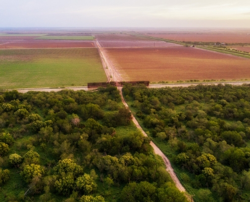
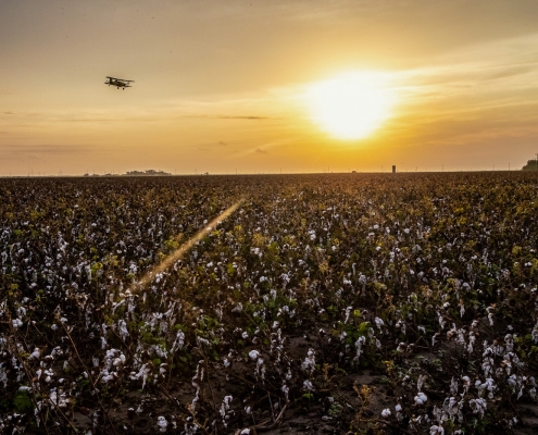
Although irrigated from the Rio Grande through a 2,000-mile network of canals and pipelines that date to 1904, cotton production and other agriculture in the Rio Grande Valley is pressured by two decades of rapid population growth. © Brian Lehmann / Circle of Blue
Reversing the Course of Federal Land Conservation
Career managers and ecologists with the U.S. Fish and Wildlife Service appear nearly helpless in defense of their conservation mission. Construction of the border wall is a facet of a striking shift in federal lands management under the Trump administration.
Since 1872, when Yellowstone National Park was established as the first federal land preserve, the government under presidencies of both parties has pursued the consistent goal of acquiring ever larger expanses of wild lands for parks, refuges, and national monuments, and managing them in a way that barred almost all ruinous industrial development.
President Trump departed from that history. In December 2017, he carved 2 million acres from two national monuments in Utah, the first time a president has eliminated protections for such big expanses of the public domain.
National wildlife refuges also are a target. In December, following decades of opposition, the administration released its plan to open 1.56 million acres of the 19 million-acre Arctic National Wildlife Refuge in Alaska to oil drilling.
It is for those reasons that the government itself, which owns the Lower Rio Grande wildlife sanctuaries, can be viewed as their gravest threat. Public opposition to the wall in the Lower Rio Grande Valley prompted Congress last year to put the Santa Ana National Wildlife Refuge, the National Butterfly Center, and a small state park off limits to wall construction. Henry Cuellar, the Democrat who represents the valley, sponsored the provision. “We cannot allow the administration’s border wall to destroy any cultural and historical landmarks in South Texas or upend lives of constituents in my district,” he said in a statement in December.
But the White House has since gained Defense Department dollars to build the wall. It’s not clear if the Cuellar restrictions will hold. Other federal refuge lands, along with state and private conservation lands, are still in play.
“The wall is going to challenge the refuge,” said Bryan Winton, who has managed the 105,000-acre Lower Rio Grande National Wildlife Refuge for the U.S. Fish and Wildlife Service since 2006. “We’ve been meeting regularly to voice our concerns about certain sensitive environments. The illegal traffic occurs throughout. They look at it from that standpoint. We look at this as the last riparian forest left. Can you take that into account and build the wall in a manner that will not severely degrade what we’re doing here? There are going to be impasses.”
For the time being, the Lower Rio Grande Valley National Wildlife Refuge has sufficient supplies of water. In acquiring lands for the refuge, the government also gained rights to 22,000 acre-feet of river flow. That’s more than enough to fill wetlands and small ponds within the refuge boundaries.
“Water is not our biggest challenge,” said Winton, before explaining the more formidable obstacles facing the public lands. “Growth and development. The wider roads, the industrial projects. We’re working to create a natural corridor along the river.”
Is one of the harmful projects the border wall? Winton is careful when answering: “Some communities don’t recognize the value of restoration, the values of eco-tourism all these years. Projects are coming here that will jeopardize that if we aren’t careful.”
Continue reading the six-part series
Water, Texas
Water, Texas is a six-part series on the consequences of the mismatch between runaway development and tightening constraints on the supply and quality of fresh water in Texas.
Funded by the Cynthia & George Mitchell Foundation.
Photography:
Brian Lehmann
Data Visualizations:
Claire Kurnick
Joe Warbington – Vizlib
Stay informed about global WaterNews and never miss any of Circle of Blue’s award-winning reporting by joining our weekly newsletter.
Have new, international water news delivered to you daily by signing up for Circle of Blue’s The Stream.
Signup for the Federal Water Tap, Brett Walton’s weekly digest of U.S. government water news.
Circle of Blue’s senior editor and chief correspondent based in Traverse City, Michigan. He has reported on the contest for energy, food, and water in the era of climate change from six continents. Contact
Keith Schneider

