Flood Study, With Fresh Approach, Measures Downside of Pavement
Using statistical methods borrowed from economics, a new study estimates the effect of hard surfaces on high waters.
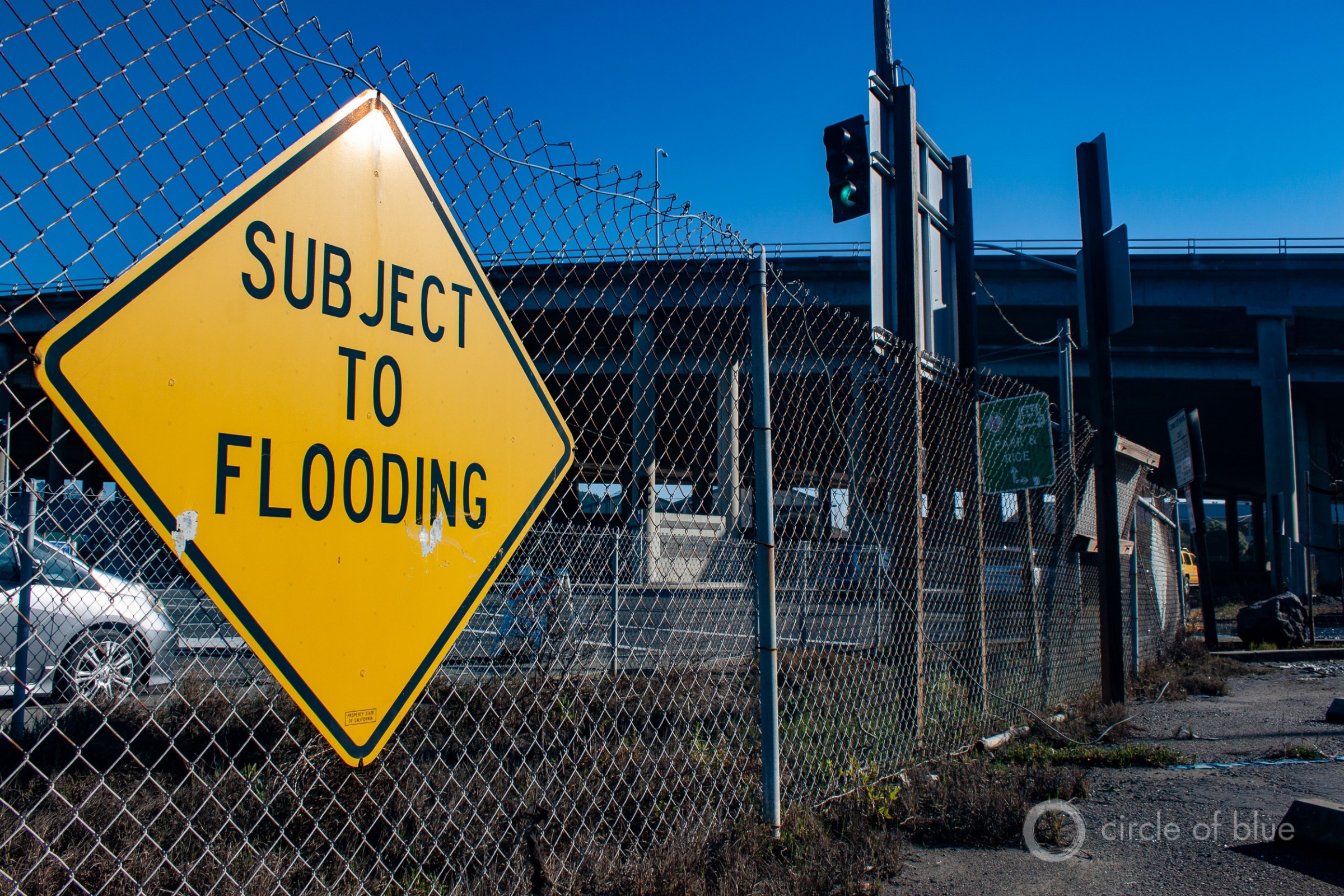
The Manzanita park and ride, located beneath Highway 101 in Marin County, floods during high tides, at least 31 times a year, according to Kate Sears, a county supervisor. “Those of those who live in this area of southern Marin get our feet wet with some regularity,” Sears told Circle of Blue. “It has a significant impact particularly in the Manzanita/Pohono area.” Photo © Brett Walton/Circle of Blue
By Brett Walton, Circle of Blue
Parking lots, streets, tin roofs — all are hard surfaces that shed water instead of absorbing it. Rather than soaking into the ground, the water is swept quickly into rivers and streams where it increases flood hazards.
But how much of a hazard are these impervious surfaces?
A new study has estimated the size of the effect. For every additional percentage point of impervious surface in a watershed — going from 5 percent coverage to 6 percent coverage, for instance — the peak of the highest flood flow of the year increases by 3.3 percent.
That number is an average across the United States, according to Annalise Blum, the study’s lead author. Local quirks of topography or development patterns may magnify or dampen the effect. But the findings are a starting point and a “ballpark estimate” for local officials who want to understand the potential flood consequences of expanding development in their region, Blum told Circle of Blue.
Impervious surfaces are the markers of urban expansion, but they produce severe side effects for watersheds — and for the developments around them. Porous ground holds water and releases it slowly, but the additional water that pavement adds to rivers could push flood flows to uncomfortable heights. Flows could even exceed the design standards for bridges, roads, or dams, which may have been built in the years before an area urbanized.
Quantifying the effect of impervious surfaces on floods is difficult. A watershed is a complex system that has tangled influences: rain storms of varying intensity, water withdrawals for cities and agriculture, wet and dry periods, reservoirs that regulate water flows.
Previous research that attempted to pull a single thread from this tangle was limited by either time or space. Most studies looked at changes in a single basin over many years. Others used a double-barreled analysis: pairing a developed watershed with a relatively undisturbed counterpart that shared a similar climate. The problem today is finding an undisturbed watershed, Blum said. “Really, those barely exist anymore,” she quipped. Still other studies enlisted computer models to simulate the changes when certain variables were tweaked.
Blum is now an AAAS Science and Technology Policy Fellow at the Department of Defense, but she completed work on the flood study as a postdoctoral researcher at Johns Hopkins University. Her motivation for the work was to bring attention to fresh analytical methods and techniques that can help answer big hydrological questions.
“So often we’re interested in why something is happening but a lot of the methods that we’ve been using for a long time in earth sciences are much more predictive — trying to predict what flood magnitude we expect next year,” Blum explained. “But understanding why it is changing is increasingly important as more and more human interventions are changing the water cycle.”
Something Borrowed For Something Blue
To understand those changes, Blum leaned on a technique borrowed from economic and social science research. Panel regression is a way to isolate the effect of a single variable in a noisy cluster, to pull at just one thread in the tangle. Blum encountered the technique before beginning her doctoral program, when she was working in east Africa with economists who were studying drinking water access.
Use of this technique is rare in the earth sciences, Blum said. A handful of other hydrology studies have used panel regressions. Researchers used it to examine the role of deforestation in large floods and the relationship between rainfall and river flows in Hawaii.
Frances Davenport, a Ph.D. student in Earth system sciences at Stanford University, told Circle of Blue that Blum’s study “represents another step in applying these causal inference techniques to understand drivers of hydrologic change.”
Davenport herself employed the panel regression technique in a study published last December on flooding in the western United States as the winter climate shifts from snow to rain. That study revealed that floods grow larger when more precipitation falls as rain than snow. The technique is best used when comparing observations from multiple watersheds over time, she said.
This is what Blum and her colleagues did. They used 39 years of data from 280 stream gauges across the United States. To reduce the influence of one variable — upstream water storage — they selected gauges that had few dams above them.
They also looked at smaller floods — not just the monstrous inundations like Hurricane Harvey, but peak flows for each year between 1974 and 2012, regardless of size. Impervious cover has more of an effect on smaller floods because in large rain events, like Harvey, saturated soils act like pavement: water cannot soak into the ground so it runs off as it would from a sidewalk. Most of the basins in the study had relatively little area covered by impervious surface. Though the high end was nearly 50 percent impervious, the median basin had just 0.44 percent impervious coverage.
The results, which were published in the journal Geophysical Research Letters, showed an average 3.3 percent increase in the annual maximum flood for each percentage point increase in impervious surface in a basin. Urban planners may want more specifics about their basin, but Blum said the national-level view is necessary because the bigger the data set across both space and time, the easier to pick out a faint thread that weaves throughout the tangle.
“Often you are really interested in a basin-specific effect,” she explained. “But it’s not possible to do a study in every basin and to have a sense for general decision making or policy, having an average effect is important.”
Blum could not detect whether the total amount of impervious surface produced a change in flow rate: if, for example, an increase from 5 percent impervious surface to 6 percent produced a larger or smaller change in the annual maximum flood compared to going from 15 percent impervious surface to 16 percent. But that doesn’t mean a relationship does not exist. Another question: does the location of impervious surface within the basin matter?
Those could be avenues for future inquiry. Blum hopes to recruit more hydrologists to these types of studies.
“It’s hard to bring new methods into a field,” Blum said. “The few studies that have used these methods I don’t think have been picked up because the people don’t understand the methods and they’re not motivated to learn new methods. It’s hard to change what you’re used to doing.”
An earlier version of this story incorrectly stated the years of data that were used in the study. The data are from 1974 to 2012, not 2974 to 2012.
Brett writes about agriculture, energy, infrastructure, and the politics and economics of water in the United States. He also writes the Federal Water Tap, Circle of Blue’s weekly digest of U.S. government water news. He is the winner of two Society of Environmental Journalists reporting awards, one of the top honors in American environmental journalism: first place for explanatory reporting for a series on septic system pollution in the United States(2016) and third place for beat reporting in a small market (2014). He received the Sierra Club’s Distinguished Service Award in 2018. Brett lives in Seattle, where he hikes the mountains and bakes pies. Contact Brett Walton






“It’s hard to bring new methods into a field,” Blum said. “The few studies that have used these methods I don’t think have been picked up because the people don’t understand the methods and they’re not motivated to learn new methods. It’s hard to change what you’re used to doing.”
Or perhaps it’s because the actual local practitioners in the fields of Hydrology and Flood Protection realize that these issues are extremely localized and generalized analysis such as the one above are not very useful is determination of policies based on the local problems and solutions.
As a small example, most cities convey stormwater from streets to creeks through drainage systems. These pipe systems are, in effect, checks and a control on how much peak flow can reach a water body. Thus, and contrary to the study above, it may be that during very high peak events, such as the 1% rain events that cause significant flooding, urbanized systems with very high hardscape %ages may develop lower stream flow peaks than natural systems that are not limited on how much peak can reach the stream. These huge watershed by watershed differences defy generalized analysis.