Climate change produces massive rains that are overwhelming the capacity to adapt.
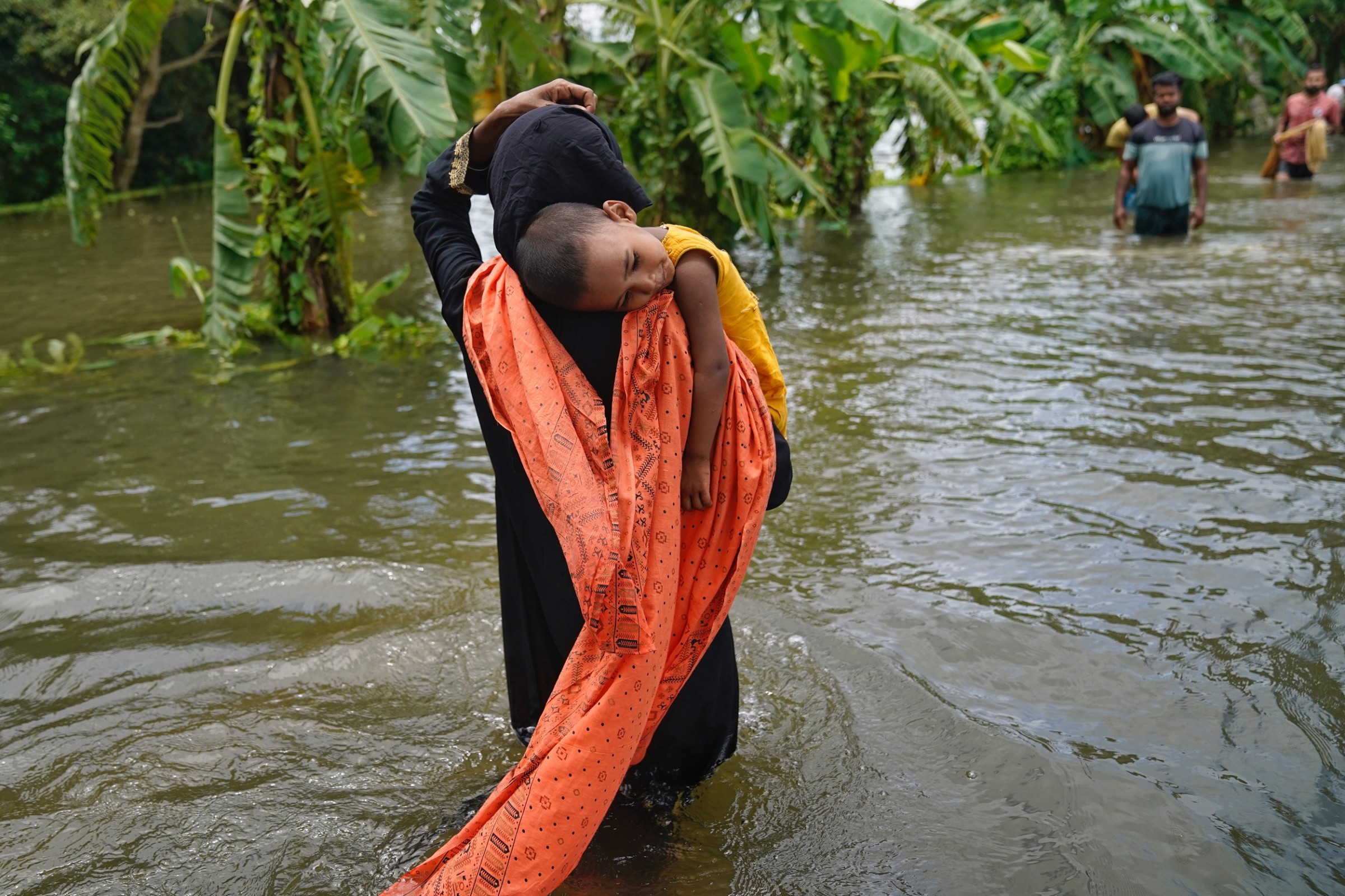
A mother carries her child through flood waters in search of shelter in Feni, a district in southern Bangladesh. Catastrophic floods in the area wreaked havoc in August 2024. Photo © UNICEF/UNI631519/Mukut
By Brett Walton, Circle of Blue – October 3, 2024
Ten minutes before Helene came ashore the night of September 26 in the Big Bend area of Florida as a monstrous Category 4 hurricane, the National Hurricane Center published an advisory bulletin.
Forecasters reiterated a warning they had repeated throughout the previous 24 hours: Helene would be a calamitous storm. Not just for the frontline Gulf Coast towns, but for communities hundreds of miles inland in the Appalachian Mountains, whose ridges and narrow valleys would also be subjected to the storm’s lacerating winds and powerful rains.
“This rainfall will likely result in catastrophic and potentially life-threatening flash and urban flooding, along with significant river flooding,” the bulletin stated. “Numerous significant landslides are expected in steep terrain across the southern Appalachians.”
Helene delivered that punch and more. Days later, when the waters receded, widespread devastation was revealed. Entire neighborhoods in North Carolina were erased. Creeks that morphed into mighty rivers had obliterated interstate highways. Millions were without power. Scores of people died.
The misery in the southern Appalachians had company globally. Helene was the capstone to a period of exceptional flood catastrophes worldwide. In the last six weeks massive storms upended tens of millions of lives from Bangladesh and Nepal to Poland, Nigeria, and North Carolina.
The volume of rain that these storms produced – two feet or more over a few days – was prodigious. In Nigeria and Poland the deluges were so great that dams ruptured, heightening the danger for those living downstream.

In September, after heavy rains and a dam collapse, a devastating flood swept through Maiduguri, a city in northeast Nigeria’s Borno state, leaving many families displaced. Photo © UNICEF/UNI644588/Marte
A warming climate is energizing these storms, causing them to grow more powerful. At the same time, flood risk is increasing due to more development in flood plains and paved surfaces replacing water-absorbing landscapes. Rising seas are an additional threat on the coasts. More people live in harm’s way while there are fewer places for surplus water to flow.
In sum, mega-storms and development patterns are overwhelming society’s capacity to cope with deluge, argues Upmanu Lall, director of the Water Institute at the Julie Ann Wrigley Global Futures Laboratory at Arizona State University.
“Given our current mechanisms for historically dealing with these things — we are out of luck at this point,” said Lall.
By “current mechanisms” Lall means coping measures like insurance, dams, flood early-warning systems, and mass exodus. All have been used with some success. Insurance is a way to share the financial risks of disaster. Dams, if they have enough capacity, can dampen peak flows downstream. Early-warning systems, like the bulletins delivered by the National Hurricane Center, signal danger days beforehand. For those who can, fleeing to higher, drier ground is an option.
All are helpful to a point, Lall said. But today insurance companies are dropping coverage in high-risk areas, dams are collapsing in record-breaking surges of water, and not everyone heeds warnings or has the means to evacuate. Stronger storms, it turns out, are delivering volumes of rainfall that are almost impossible to counteract. “We are in a situation where we are unprepared to deal with these things,” he said.
Consider the activity in recent weeks.
- At the end of August a low pressure system in the Indian Ocean resulted in a flood emergency in eastern Bangladesh. The storm added to the estimated 6 million people in the country who were affected by floods this summer.
- In early September, Super Typhoon Yagi crossed Southeast Asia, killing more than 500 people in floods and landslides.
- Central Europe was inundated in mid-September with a four-day rain, the strongest such storm on record in the area, which caused dams to burst in Czechia and Poland. World Weather Attribution, a group that investigates the climate fingerprint of extreme weather, found the event to be twice as likely and 7 percent more intense due to human-induced warming of the planet.
- A summer of heavy rains in northern Nigeria led to the collapse of Alau Dam, near the city of Maiduguri. More than 640,000 people have been displaced in the region and two bridges in Maiduguri were destroyed. At least 285 people died in floods, Nigerian authorities say.
- Parts of Kathmandu were underwater at the end of September after more than a foot of rain fell in less than three days in an area already sodden from earlier monsoon storms. The Nepali capital was cut off after landslides blocked its three main highways, the AP reported. The Bagmati River was 7 feet above its “danger level,” according to the research group ICIMOD.
For the flooding around Kathmandu, storms are not the only factor. “It is important to stress that the rainfall alone wasn’t solely responsible for the extent of the damage,” said Arun Bhakta Shrestha, climate and environmental risks lead at ICIMOD.
“Unchecked urban development has left little open land to absorb water, while natural drainage systems have been altered or encroached upon,” Shrestha wrote in an email. “River flood plains have been built over, and poor drainage systems cannot cope with extreme events. Illegal stone mining has further destabilized slopes, leading to excessive debris and mud being washed into river systems, compounding the flood damage.”
These land-use decisions are not helped by the physics behind extreme rainfall. A warmer atmosphere holds more water vapor – an increase of 7 percent for each 1 degree C rise in global temperature.
Today’s global average temperature is about 1.3 degrees C above where it was 200 years ago. The IPCC, the UN’s climate science panel, concluded that heavy precipitation will be “more frequent and more intense” with additional warming due to the accumulation of heat-trapping gases like carbon dioxide.
Tom Knutson, a senior scientist at NOAA’s Geophysical Fluid Dynamics Laboratory, compares hurricanes to “a big engine” that draws in air and the water vapor it holds.
“When the whole system has more water vapor in it, this whole process of air convergence and moisture convergence toward the center of the storm is ramped up,” Knutson told the Sustain What podcast, in June.
The numbers from Helene tell that story of supreme hydrologic excess. The French Broad River, which flows through Asheville, near the epicenter of the storm’s deluge, crested at a record 24.6 feet – some 15 feet above the level where the river begins to overflow its banks. In areas just east of Asheville more than two feet of rain was measured.
For Lall, these figures reflect the limitations of traditional adaptation measures in the face of mega-storms.
“Even if you had a three-day warning, five-day warning, or even a week warning, there’s almost nothing you can do because what we have done in the past with good warning is put out sandbags,” Lall said. “For the kind of event you just described, sandbags aren’t going to cut it.”
This story has been updated with comments about the flooding around Kathmandu.

Brett writes about agriculture, energy, infrastructure, and the politics and economics of water in the United States. He also writes the Federal Water Tap, Circle of Blue’s weekly digest of U.S. government water news. He is the winner of two Society of Environmental Journalists reporting awards, one of the top honors in American environmental journalism: first place for explanatory reporting for a series on septic system pollution in the United States(2016) and third place for beat reporting in a small market (2014). He received the Sierra Club’s Distinguished Service Award in 2018. Brett lives in Seattle, where he hikes the mountains and bakes pies. Contact Brett Walton